
IMAGES TAKEN NEAR TO
Sheil Place, LIVINGSTON, EH53 0FD
Introduction
This page details the photographs taken nearby to Sheil Place, EH53 0FD by members of the Geograph project.
The Geograph project started in 2005 with the aim of publishing, organising and preserving representative images for every square kilometre of Great Britain, Ireland and the Isle of Man.

There are currently over 7.5m images from over14,400 individuals and you can help contribute to the project by visiting https://www.geograph.org.uk
Image Map
Images are licensed for reuse under creativecommons.org/licenses/by-sa/2.0
Notes
- Clicking on the map will re-center to the selected point.
- The higher the marker number, the further away the image location is from the centre of the postcode.
Image Listing (22 Images Found)
Images are licensed for reuse under creativecommons.org/licenses/by-sa/2.0
Image
Details
Distance
1

New housing at East Calder
The beginnings of Calderwood, a large new housing development on a green-field site on the edge of the Almondell and Calder Wood Country Park. This part is Sheil Lane - two adjacent farms are Overshiel and Nethershiel - but 'sheil' seems to be the spelling for the street name.
Image: © M J Richardson
Taken: 9 Aug 2017
0.08 miles
2

New housing estate at East Calder, from the air
Image: © Mike Pennington
Taken: 5 Jul 2016
0.09 miles
3
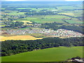
New housing estate at East Calder
On the edge of Almondell and Calderwood Country Park, with the valley of the River Almond in the lower half of the picture. For a ground view see Image
Image: © M J Richardson
Taken: 11 Jul 2018
0.10 miles
4

A Baby Burial Ground
This is an area of the new Almondell Cemetery, at the East end of East Calder, reserved for, as far as I can gather, miscarried and stillborn babies. The bench in the picture was donated by a charity called Sands, which stands for 'Stillborn And Neonatal DeathS' I think, or at least something very similar. The reason I think it must also cover miscarriages is that their online guidance talks about ashes from very young unborn babies - for some reason 17 weeks is a cut-off point, presumably because on average bones don't become bones as we know them until this point.
Until walking around the new cemetery today I had never really thought in depth about such things, but I'm wondering if it is a designated area due to the fact that that, officially, a person cannot be declared to be dead if they have never lived. If so, it seems to me a very good development. Whilst there were only two gravestones in this area when I visited, there were only about 40 'normal' graves in other areas, which provides a sobering remunder of how widespread this occurrence and the resulting heartache is.
Image: © Ian Dodds
Taken: 26 Jun 2022
0.10 miles
5

A Swale
This is a swale. The definition of a swale, when requested from the internet, almost always gives a definition like : 'a low or hollow place, especially a marshy depression between ridges'. The only time I have ever come across the word though, is to describe a man-made thing, which mitigates flooding. They are kind of budget balancing ponds. In urban settings the water that gathers in them always gets directed straight into drains. In settings like this (a recently built cemetery) what happens to the water is not so clear. I think it just gathers in the dip and slowly infiltrates into the ground below, so as to avoid flooding issues created by high water runoff during heavy downpours.
The picture is a bit of an optical illusion. Whilst it looks like the low trees are growing out of the lowest ground they are not. The ground is actually lower to the left amongst the tall grass. It wasn't actually that wet in there, but in horse-racing terms the going would be described as soft.
Image: © Ian Dodds
Taken: 26 Jun 2022
0.10 miles
6

Gap in the Estate
The current map shows the houses on the left, but not those on the right. I am a little puzzled by this gap between their garden ground, for which there seems to be no reason. Perhaps time will tell.
Image: © Anne Burgess
Taken: 21 Feb 2018
0.13 miles
7
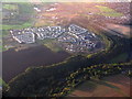
New housing estate at East Calder
On the edge of Almondell and Calderwood Country Park, with the valley of the River Almond in the lower half of the picture. For a ground view see Image
Image: © M J Richardson
Taken: 30 Sep 2017
0.14 miles
8
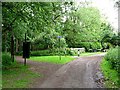
South entrance, Almondell and Calder Wood Country Park
At East Calder. The blue sign indicates the route of National Cycle Network route 75 which runs from Glasgow to Edinburgh.
Image: © Oliver Dixon
Taken: 17 Jun 2011
0.16 miles
9

Daffodils, Almondell & Calder Wood Country Park
Floral display near the southern entrance of the Country Park near East Calder.
Image: © Chris Heaton
Taken: 22 Apr 2008
0.17 miles
10

Calderwood Estate
The end of the road into Calderwood is still flanked by construction sites, though the houses in the northern part of the estate are occupied.
Image: © Anne Burgess
Taken: 21 Feb 2018
0.18 miles