
A Swale
Introduction
The photograph on this page of A Swale by Ian Dodds as part of the Geograph project.
The Geograph project started in 2005 with the aim of publishing, organising and preserving representative images for every square kilometre of Great Britain, Ireland and the Isle of Man.

There are currently over 7.5m images from over 14,400 individuals and you can help contribute to the project by visiting https://www.geograph.org.uk
A Swale
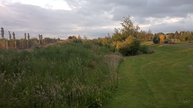
Image: © Ian Dodds Taken: 26 Jun 2022
This is a swale. The definition of a swale, when requested from the internet, almost always gives a definition like : 'a low or hollow place, especially a marshy depression between ridges'. The only time I have ever come across the word though, is to describe a man-made thing, which mitigates flooding. They are kind of budget balancing ponds. In urban settings the water that gathers in them always gets directed straight into drains. In settings like this (a recently built cemetery) what happens to the water is not so clear. I think it just gathers in the dip and slowly infiltrates into the ground below, so as to avoid flooding issues created by high water runoff during heavy downpours. The picture is a bit of an optical illusion. Whilst it looks like the low trees are growing out of the lowest ground they are not. The ground is actually lower to the left amongst the tall grass. It wasn't actually that wet in there, but in horse-racing terms the going would be described as soft.
Images are licensed for reuse under creativecommons.org/licenses/by-sa/2.0
Image Location

Latitude
55.898612
Longitude
-3.452229