
IMAGES TAKEN NEAR TO
Bridgeness Road, BO'NESS, EH51 9SG
Introduction
This page details the photographs taken nearby to Bridgeness Road, EH51 9SG by members of the Geograph project.
The Geograph project started in 2005 with the aim of publishing, organising and preserving representative images for every square kilometre of Great Britain, Ireland and the Isle of Man.

There are currently over 7.5m images from over14,400 individuals and you can help contribute to the project by visiting https://www.geograph.org.uk
Image Map
Images are licensed for reuse under creativecommons.org/licenses/by-sa/2.0
Notes
- Clicking on the map will re-center to the selected point.
- The higher the marker number, the further away the image location is from the centre of the postcode.
Image Listing (31 Images Found)
Images are licensed for reuse under creativecommons.org/licenses/by-sa/2.0
Image
Details
Distance
1
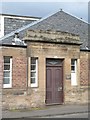
Victoria Sawmills entrance
An old doorway, the mills have given their name to the modern industrial estate, Victoria Mills, which is still dominated by sawmills.
Image: © Richard Webb
Taken: 4 Sep 2009
0.03 miles
2
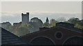
Bridgeness tower
Taken from top of pedestrian bridge over railway
Railway shed roofs in foreground
Image: © Bob Simpson
Taken: 8 May 2010
0.06 miles
3
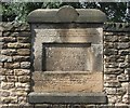
Roman Distance slab (?The Bridgeness Slab?)
On a wall near the spot where the original stone was found in Harbour Road is a copy of the inscription. It marks a portion of the Antonine wall built by the Second Legion. Mr Henry Cadell of the Grange, owner of the estate when it was excavated in 1869 offered the stone to The Society of Antiquaries of Scotland for display in the National Museum of Scotland in Edinburgh if they would provide a copy for display locally. In addition to the Latin inscription the original has sculpted panels. On the left is a victorious Roman cavalryman with his victims and on the right is a victory sacrifice in progress.
There are photographs in “Roman Distance Slabs From the Antonine Wall” by Lawrence Keppie, Hunterian Museum, Glasgow. ISBN 0-904254-02-X
The original description is in the proceedings of the Society of Antiquaries of Scotland Vol 8 (1868-69) page 109 - 113
Image: © Tom Sargent
Taken: 20 Aug 2007
0.06 miles
4
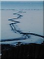
Low tide at Bo'ness
Low tide reveals extensive mudflats at Bo'ness, cut by meandering rivulets, which look very eerie in the blue dusk light. The Fife coast is seen through the gloom.
Image: © Steve Kent
Taken: 20 Nov 2005
0.07 miles
5
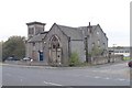
Previous St Andrews Church
Built in 1904 this building ceased to be a church in the 1950s and became a social club. It was demolished in 2006 to make way for new housing.
Image: © Tom Sargent
Taken: 27 Oct 2004
0.08 miles
6
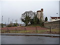
Bridgeness Tennis court and Bridgeness tower
Image: © Bob Simpson
Taken: 5 Jan 2011
0.08 miles
7
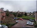
Bridgeness tower & Grange nursing home
Photo taken from Birdland avenue looking over Kinnacres park onto Grange nursing home with Bridgeness tower visible in the background
Image: © Bob Simpson
Taken: 5 Jan 2011
0.10 miles
8
Bridgeness Tower, Tower Gardens, Bo'ness
Image: © Jo and Steve Turner
Taken: 20 Jun 2014
0.10 miles
9
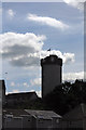
Bridgeness Tower, Tower Gardens, Bo'ness
Image: © Jo and Steve Turner
Taken: 20 Jun 2014
0.10 miles
