
IMAGES TAKEN NEAR TO
Liddle Drive, BO'NESS, EH51 0PB
Introduction
This page details the photographs taken nearby to Liddle Drive, EH51 0PB by members of the Geograph project.
The Geograph project started in 2005 with the aim of publishing, organising and preserving representative images for every square kilometre of Great Britain, Ireland and the Isle of Man.

There are currently over 7.5m images from over14,400 individuals and you can help contribute to the project by visiting https://www.geograph.org.uk
Image Map
Images are licensed for reuse under creativecommons.org/licenses/by-sa/2.0
Notes
- Clicking on the map will re-center to the selected point.
- The higher the marker number, the further away the image location is from the centre of the postcode.
Image Listing (6 Images Found)
Images are licensed for reuse under creativecommons.org/licenses/by-sa/2.0
Image
Details
Distance
1
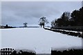
Pennelton Place common land
Snowed over common land at pennelton place boness.
Image: © edward mcmaihin
Taken: 26 Dec 2009
0.10 miles
2

Pennelton place
Pennelton place Boness.
Image: © edward mcmaihin
Taken: 26 Dec 2009
0.10 miles
3

Snowy brae
Snowy road at Pennelton place,Boness looking south.
Image: © edward mcmaihin
Taken: 26 Dec 2009
0.13 miles
4

Business Park
Several small businesses have been given premises and grants to start up here
Image: © Tom Sargent
Taken: 26 Aug 2007
0.18 miles
5
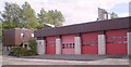
Fire Station
Strictly speaking Bo’ness is not big enough for a full station but being right next to the petrochemical complex at Grangemouth means increased risk.
Image: © Tom Sargent
Taken: 26 Aug 2007
0.24 miles
6
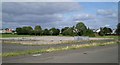
Derelict Factory
This site once held a clothing factory providing shirts, track suits and athletic kit for large stores. The work could be don cheaper abroad and the factory closed.
Image: © Tom Sargent
Taken: 26 Aug 2007
0.24 miles