
IMAGES TAKEN NEAR TO
Golf Course Road, LINLITHGOW, EH49 6EL
Introduction
This page details the photographs taken nearby to Golf Course Road, EH49 6EL by members of the Geograph project.
The Geograph project started in 2005 with the aim of publishing, organising and preserving representative images for every square kilometre of Great Britain, Ireland and the Isle of Man.

There are currently over 7.5m images from over14,400 individuals and you can help contribute to the project by visiting https://www.geograph.org.uk
Image Map
Images are licensed for reuse under creativecommons.org/licenses/by-sa/2.0
Notes
- Clicking on the map will re-center to the selected point.
- The higher the marker number, the further away the image location is from the centre of the postcode.
Image Listing (38 Images Found)
Images are licensed for reuse under creativecommons.org/licenses/by-sa/2.0
Image
Details
Distance
1

Mains Burn, Linlithgow
Another example of completely unsympathetic treatment of a natural environment.Image] The burn had previously followed a meandering course from one side of the Golf Course Road to the other providing many pools containing small trout. Yet again, the demands of the house builders meant that it had to be "improved" by straightening it. One effect of this was to guarantee that any flood water would now run off much more rapidly, resulting in an increased flood risk downstream. This is surely an example of civil engineering at its very worst. It's ok if you really need anti-tank defences but as a natural habitat it leaves a lot to be desired.
Image: © AlastairG
Taken: 27 Mar 2011
0.03 miles
2

Mains Burn, Linlithgow
The same section as in Image The heavy duty grating on the far bank is all that remains of the burn's meanders. Ugly or what?
Image: © AlastairG
Taken: 27 Mar 2011
0.04 miles
3

Pipebridge crossing the Union Canal in Linlithgow
Image: © Mat Fascione
Taken: 2 Jun 2016
0.06 miles

5

Union Canal - the Dark Brig
The name says it all. The road to the local golf club passes under the canal. The grating in the road is one of several installed to reduce flooding when the burn on the upstream side of the bridge burst its banks, sending a spate down the road to nearby houses. The trees on the left are part of Arnut Wood. The arnuts being earthnuts which local boys used to dig up and eat.
Image: © AlastairG
Taken: 28 Oct 2008
0.07 miles

7
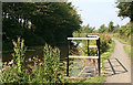
Level Regulator
The white railing surrounds a spillway. I am not sure if this is the correct term for them, but I am lost in admiration of the canal builders in the early 19th century who were able to build a whole series of these little spillways along the whole length of the canal, all of them at exactly the same height, to maintain the level of water in the canal.
Image: © Anne Burgess
Taken: 26 Aug 2013
0.08 miles
8

Union Canal - the Dark Brig
The Dark Brig is slightly less gloomy seen from the south but even on this bright early winter's day it remains a sunless place. The culvert in the foreground leads the Mains Burn into a tunnel under the bridge under the canal! Quite a piece of engineering.
Image: © AlastairG
Taken: 28 Oct 2008
0.08 miles
9

Not a Bridge
This structure seems to exist only to carry a pipe across the canal. The vegetation in the foreground is mostly seeding heads of Queen of the Meadows, also known as Meadowsweet (Filipendula ulmaria). There is a glimpse through the trees of the golf club house.
Image: © Anne Burgess
Taken: 26 Aug 2013
0.08 miles
10

A Stretch of the Union Canal
Just to the west of Linlithgow, close to the golf course club house.
Image: © Chris Heaton
Taken: 9 Aug 2009
0.09 miles