
Mains Burn, Linlithgow
Introduction
The photograph on this page of Mains Burn, Linlithgow by AlastairG as part of the Geograph project.
The Geograph project started in 2005 with the aim of publishing, organising and preserving representative images for every square kilometre of Great Britain, Ireland and the Isle of Man.

There are currently over 7.5m images from over 14,400 individuals and you can help contribute to the project by visiting https://www.geograph.org.uk
Mains Burn, Linlithgow
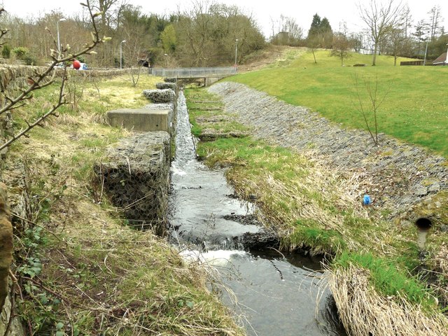
Image: © AlastairG Taken: 27 Mar 2011
Another example of completely unsympathetic treatment of a natural environment.Image] The burn had previously followed a meandering course from one side of the Golf Course Road to the other providing many pools containing small trout. Yet again, the demands of the house builders meant that it had to be "improved" by straightening it. One effect of this was to guarantee that any flood water would now run off much more rapidly, resulting in an increased flood risk downstream. This is surely an example of civil engineering at its very worst. It's ok if you really need anti-tank defences but as a natural habitat it leaves a lot to be desired.
Images are licensed for reuse under creativecommons.org/licenses/by-sa/2.0
Image Location

Latitude
55.968174
Longitude
-3.617302