
IMAGES TAKEN NEAR TO
Starlaw Avenue, BATHGATE, EH48 1LJ
Introduction
This page details the photographs taken nearby to Starlaw Avenue, EH48 1LJ by members of the Geograph project.
The Geograph project started in 2005 with the aim of publishing, organising and preserving representative images for every square kilometre of Great Britain, Ireland and the Isle of Man.

There are currently over 7.5m images from over14,400 individuals and you can help contribute to the project by visiting https://www.geograph.org.uk
Image Map
Images are licensed for reuse under creativecommons.org/licenses/by-sa/2.0
Notes
- Clicking on the map will re-center to the selected point.
- The higher the marker number, the further away the image location is from the centre of the postcode.
Image Listing (11 Images Found)
Images are licensed for reuse under creativecommons.org/licenses/by-sa/2.0
Image
Details
Distance
1

Viewing bays without a view
I don't know what these bays are (there are three in total) or what purpose they could possibly serve. They look like viewing platforms, and whilst the small narrow wood they look out onto is pleasant enough, it could hardly be described as anything special. Plus the view from the walkway - which leads from a footbridge over a railway line to a tarmacked path that leads to a main road - is just the same.
I did have a silly fleeting notion that they might be some kind of horse passing places. There are a great deal of reasons this can't be the case, the main one being that I have never seen a horse walking up or down a flight of steps.
Image: © Ian Dodds
Taken: 6 Jan 2023
0.10 miles
2

Railway : Bathgate
Recently upgraded to double track.
Image: © Jim Smillie
Taken: 13 May 2009
0.11 miles
3

Edinburgh Road
As it passes Bathgate Academy on the left.
Image: © Jim Smillie
Taken: 13 May 2009
0.12 miles

6

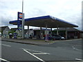
Heading for Edinburgh on the A7066
The A7066 by-passes Bathgate as far as the A801 which reconnects with the A89 at the west end of the town. The gritters were out on this bright but icy December morning.
Image: © Mary and Angus Hogg
Taken: 26 Dec 2023
0.15 miles
7
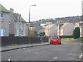
Boghall
Housing scheme on the east side of Bathgate. The old map just shows hilly farmland. View west.
The houses were built to take in overspill from Glasgow and house the workers for the truck factory, now itself a big new housing project.
Image: © Richard Webb
Taken: 16 Jan 2006
0.16 miles
8

Former railway bridge, Bathgate
Bridge under the A7066 now used by the NCN75 cycle path through the Pyramids Business Park.
Image: © Richard Webb
Taken: 13 Jun 2008
0.18 miles
9
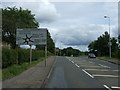
Approaching Boghall Roundabout
Heading east on Edinburgh Road (A89).
Image: © JThomas
Taken: 11 Jul 2015
0.21 miles
10
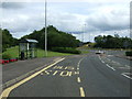
Bus stop on Edinburgh Road (A89)
Near Boghall Roundabout.
Image: © JThomas
Taken: 11 Jul 2015
0.23 miles