
IMAGES TAKEN NEAR TO
Cannop Crescent, BATHGATE, EH47 8EH
Introduction
This page details the photographs taken nearby to Cannop Crescent, EH47 8EH by members of the Geograph project.
The Geograph project started in 2005 with the aim of publishing, organising and preserving representative images for every square kilometre of Great Britain, Ireland and the Isle of Man.

There are currently over 7.5m images from over14,400 individuals and you can help contribute to the project by visiting https://www.geograph.org.uk
Image Map
Images are licensed for reuse under creativecommons.org/licenses/by-sa/2.0
Notes
- Clicking on the map will re-center to the selected point.
- The higher the marker number, the further away the image location is from the centre of the postcode.
Image Listing (15 Images Found)
Images are licensed for reuse under creativecommons.org/licenses/by-sa/2.0
Image
Details
Distance

2

Road through Bents and Stoneyburn
The sign on the lamppost states 'humps' 1645yds.
The number of speed bumps on this stretch of road prompted letters for and against in the local paper.
Image: © Jim Smillie
Taken: 11 May 2009
0.04 miles

4

Bents, West Lothian
View of the older part of this village which in recent years has extended eastwards making it a surprisingly long village.
Image: © Kevin Rae
Taken: 17 Apr 2006
0.09 miles
5

Bents Station (remnants)
View SW, towards Morningside; ex-NB Bathgate - Morningside line. Bents Station was closed to passengers when service were withdrawn 1/5/30 and to goods on 2/5/55. However the line was evidently still in use when photographed in 9/62, so when it was finally taken up is a mystery -- to me. Does anyone know?
Image: © Ben Brooksbank
Taken: 12 Sep 1962
0.11 miles
6

Houses on Hens Nest Road, Stoneyburn
Showing position of Postbox No. EH47 60.
See Image] for postbox.
Image: © JThomas
Taken: 17 Sep 2021
0.14 miles
7
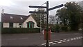
Old Signpost, Bents
I have no idea how old this signpost is, but its black/gold-on-black design obviously wasn't aimed at motorists (then again, maybe paint has fallen off bits of it over time). West Lothian, unlike some other parts of Scotland (and most parts of England, from what I have seen) has very few remaining old distance signposts.
There are no longer official signposts giving distances as accurately as this; presumably this is because signposts today are designed for the motorist, as opposed to walkers, cyclists on heavy old bikes, and people on horseback, for whom an eighth of a mile was a quantifiable distance in terms of time taken to cover the ground.
Our current roadsigns follow a design brought in in the mid 1960s, precipitated by the advent of the motorways and, unlike this old sign, they never have a slash, or bar if you like, between the numbers in the fraction. This was apparently done to avoid clutter on the new roadsigns increasing the time taken by motorists to process the information conveyed. It is often claimed that UK roadsigns are the only places you will see a fraction officially depicted without a line dividing the two numbers.
Image: © Ian Dodds
Taken: 10 Oct 2022
0.14 miles
8

Postbox on Hens Nest Road, Stoneyburn
Postbox No. EH47 60.
See Image] for context.
Image: © JThomas
Taken: 17 Sep 2021
0.15 miles

