IMAGES TAKEN NEAR TO
Beechwood Road, BATHGATE, EH47 7PF
Introduction
This page details the photographs taken nearby to Beechwood Road, EH47 7PF by members of the Geograph project.
The Geograph project started in 2005 with the aim of publishing, organising and preserving representative images for every square kilometre of Great Britain, Ireland and the Isle of Man.

There are currently over 7.5m images from over14,400 individuals and you can help contribute to the project by visiting https://www.geograph.org.uk
Image Map
Images are licensed for reuse under creativecommons.org/licenses/by-sa/2.0
Notes
- Clicking on the map will re-center to the selected point.
- The higher the marker number, the further away the image location is from the centre of the postcode.
Image Listing (10 Images Found)
Images are licensed for reuse under creativecommons.org/licenses/by-sa/2.0
Image
Details
Distance
1

A Disintegrating Tree
It is unlikely this beautiful old tree will be around for many more years, so catch it while you can! It isn't huge; it's more the fact that it looks like an old tree should look that makes it special. The wood on the inside of the hollow trunk is damp and flaking, but not properly rotten yet.
It sits just off a muddy path leading into a small woodland, which is opposite a long line of old terraced garages. The nailed-on sign is a bit curious - maybe it pointed somewhere once, but nowadays it just points to some thickets at the back of garden fences on Beechwood Gardens.
Image: © Ian Dodds
Taken: 18 Mar 2022
0.06 miles
2

Rowan Drive Blackburn
Variety of housing types. Like much of West Lothian the pavements are covered in grit spread during severe weather in December/January.
Image: © Jim Smillie
Taken: 7 Mar 2011
0.13 miles
3

Rowan Drive, Blackburn
A housing estate on the eastern edge of the village.
Image: © M J Richardson
Taken: 5 Sep 2018
0.14 miles
4

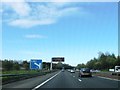
M8 West Lothian
From bridge carrying Bathgate Road over motorway
Image: © Jim Smillie
Taken: 7 Mar 2011
0.16 miles
5

Open Land behind Blackburn
Only a small fraction of this grid-square isn't taken over by urban development. This land sits between houses at the NorthEast of Blackburn and the M8 motorway; it contains a number of paths - unmarked on even the most detailed online mapping - and a great deal of rubbish.
Like a lot of semi-wasteland it has a certain appeal and feeling of discovery about it. The piles of mossy stones in the foreground sadly don't seem to tie in with any previous structure around here though - they are probably just the result of ground getting cleared for woodland or drainage ditches.
Image: © Ian Dodds
Taken: 18 Mar 2022
0.20 miles
6
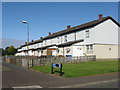
Rowan Drive, Blackburn
One of many short terraces of houses on the northeast edge of Blackburn.
Image: © M J Richardson
Taken: 5 Sep 2018
0.21 miles
7
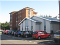
Murrayfield House, Blackburn
One of two blocks of flats that are part of the Council’s Homeless Management Programme [the other, Mossview, is just out of view on the right]. They are connected by the new grey building, which is the Rowan Drive Homeless Persons Unit.
Image: © M J Richardson
Taken: 5 Sep 2018
0.21 miles
8
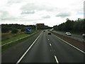
The M8 passing Blackburn
With the 1-mile advance marker for J4 and an information gantry.
Image: © M J Richardson
Taken: 24 Aug 2013
0.21 miles
9

A wet afternoon in Blackburn
Looking across Bathgate Road.
Image: © Richard Webb
Taken: 16 Dec 2008
0.23 miles