
IMAGES TAKEN NEAR TO
Pentland View, BATHGATE, EH47 0JP
Introduction
This page details the photographs taken nearby to Pentland View, EH47 0JP by members of the Geograph project.
The Geograph project started in 2005 with the aim of publishing, organising and preserving representative images for every square kilometre of Great Britain, Ireland and the Isle of Man.

There are currently over 7.5m images from over14,400 individuals and you can help contribute to the project by visiting https://www.geograph.org.uk
Image Map
Images are licensed for reuse under creativecommons.org/licenses/by-sa/2.0
Notes
- Clicking on the map will re-center to the selected point.
- The higher the marker number, the further away the image location is from the centre of the postcode.
Image Listing (13 Images Found)
Images are licensed for reuse under creativecommons.org/licenses/by-sa/2.0
Image
Details
Distance
1

East Whitburn Gothenburg
The Goth in East Whitburn seems a lot younger than the time of the Gothenburgs - public houses as social centres. These were common in mining communities and usually date to the early 20th century. I expect this is built on the site of an older building.
Image: © Richard Webb
Taken: 13 Jun 2008
0.06 miles
2

Bridge at East Whitburn
There was a station here on the Morningside (Lanarkshire) to Bathgate line.
Image: © Jim Smillie
Taken: 13 Jan 2009
0.07 miles
3

Main Street, East Whitburn
View westwards, past the Gothenburg (community public house) which is for sale.
Image: © Richard Webb
Taken: 21 Apr 2010
0.09 miles
4

Football pitch
Also used for East Whitburn Gala Day sports.
Image: © Jim Smillie
Taken: 19 Mar 2009
0.13 miles
5

Old Railway Bridge near M8
I had originally assumed, wrongly, that this bridge was built to allow continued passage of an old road or farm track. Old OS maps though, going back to the earliest 1850s one, show that it was actually there to allow a mill lade, or race, to flow uninterrupted to Redmill corn and barley mill - it looks a bit oversized for its purpose to me, but I suppose they didn't do things by halves back then.
Redmill is now the name of the Eastern part of East Whitburn but originally the mill was all that was there.
It didn't provide me with any further information, but an interesting discovery while trying to find out more about the mill, was the existence of an old publication called 'Slater's Royal National Commercial Directory of Scotland'. This was published annually between the late 1700s and early 1900s and apparently changed its name occasionally over the years. It was basically a Yellow Pages without phone numbers. It also doesn't bother with addresses either, a village name was obviously deemed quite sufficient back then! It could be a handy resource nevertheless, and it can be viewed online at the National Library of Scotland site.
Image: © Ian Dodds
Taken: 7 May 2021
0.15 miles
6

Children's play area, Redmill Park, Whitburn
Image: © Leslie Barrie
Taken: 20 May 2015
0.17 miles
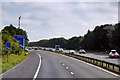
8

Redmill from the air
On the A705 road between Blackburn and Whitburn.
Image: © Thomas Nugent
Taken: 7 Feb 2020
0.19 miles
9

White Burn flows under M8
Shortly before it meets the Almond.
Image: © Jim Smillie
Taken: 13 Jan 2009
0.22 miles
10

M8 eastbound nears Junction 4 at Whitburn
Image: © Colin Pyle
Taken: 5 Jun 2013
0.22 miles