
Old Railway Bridge near M8
Introduction
The photograph on this page of Old Railway Bridge near M8 by Ian Dodds as part of the Geograph project.
The Geograph project started in 2005 with the aim of publishing, organising and preserving representative images for every square kilometre of Great Britain, Ireland and the Isle of Man.

There are currently over 7.5m images from over 14,400 individuals and you can help contribute to the project by visiting https://www.geograph.org.uk
Old Railway Bridge near M8
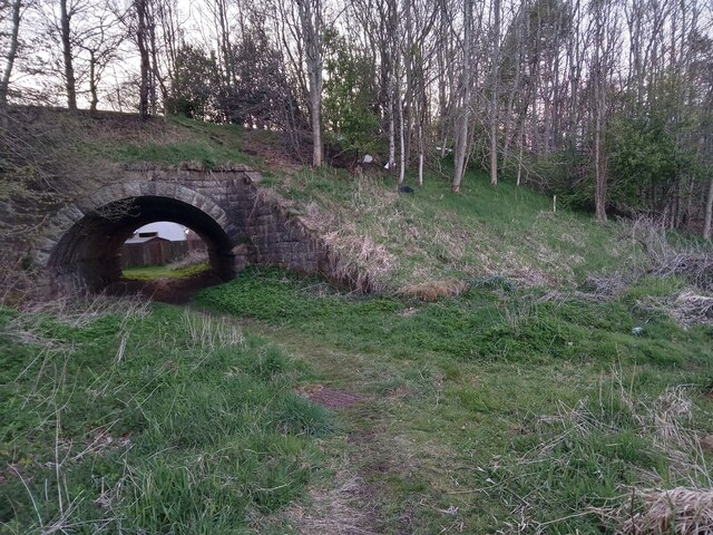
Image: © Ian Dodds Taken: 7 May 2021
I had originally assumed, wrongly, that this bridge was built to allow continued passage of an old road or farm track. Old OS maps though, going back to the earliest 1850s one, show that it was actually there to allow a mill lade, or race, to flow uninterrupted to Redmill corn and barley mill - it looks a bit oversized for its purpose to me, but I suppose they didn't do things by halves back then. Redmill is now the name of the Eastern part of East Whitburn but originally the mill was all that was there. It didn't provide me with any further information, but an interesting discovery while trying to find out more about the mill, was the existence of an old publication called 'Slater's Royal National Commercial Directory of Scotland'. This was published annually between the late 1700s and early 1900s and apparently changed its name occasionally over the years. It was basically a Yellow Pages without phone numbers. It also doesn't bother with addresses either, a village name was obviously deemed quite sufficient back then! It could be a handy resource nevertheless, and it can be viewed online at the National Library of Scotland site.
Images are licensed for reuse under creativecommons.org/licenses/by-sa/2.0
Image Location

Latitude
55.871198
Longitude
-3.658978