
IMAGES TAKEN NEAR TO
Crarae Avenue, EDINBURGH, EH4 3JD
Introduction
This page details the photographs taken nearby to Crarae Avenue, EH4 3JD by members of the Geograph project.
The Geograph project started in 2005 with the aim of publishing, organising and preserving representative images for every square kilometre of Great Britain, Ireland and the Isle of Man.

There are currently over 7.5m images from over14,400 individuals and you can help contribute to the project by visiting https://www.geograph.org.uk
Image Map
Images are licensed for reuse under creativecommons.org/licenses/by-sa/2.0
Notes
- Clicking on the map will re-center to the selected point.
- The higher the marker number, the further away the image location is from the centre of the postcode.
Image Listing (119 Images Found)
Images are licensed for reuse under creativecommons.org/licenses/by-sa/2.0
Image
Details
Distance
1

North Edinburgh Cycleway near Roseburn
The surfaced cyclepath between Coltbridge Viaduct and Ravelston.
Image: © Jim Barton
Taken: 21 Jun 2016
0.03 miles
2

Walkway approaching bridge at Ravelston Dykes
The view of the walkway and cyclepath on the Murrayfield to Craigleith section of the Granton and Leith branch of the former Caledonian Railway.
The bridge carries Ravleston Dykes over the walkway and cyclepath which follows the route of the disused railway line.
Image: © Sandy Gemmill
Taken: 22 Jan 2007
0.05 miles
3
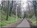
The Roseburn Path
A very useful rails to trails conversion in West Edinburgh.
Image: © Richard Webb
Taken: 27 Mar 2021
0.06 miles
4

Ravelston Dykes
Road running along a shallow eastern ridge of Corstorphine Hill.
Image: © Callum Black
Taken: 3 Jun 2006
0.07 miles
5

Bridge over former railway, now Roseburn Path
Ravelston Dykes crosses the route of the Caledonian line to Granton and Leith.
Image: © Robin Webster
Taken: 20 Oct 2019
0.08 miles
6
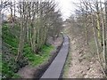
Roseburn Path
A footpath and cycle track, which used to be part of Edinburgh's Suburban Railway system, taken from the bridge at Coltbridge Terrace, looking north.
Image: © M J Richardson
Taken: 27 Mar 2008
0.09 miles
7
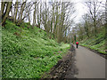
Roseburn Path
A former railway converted into a cycle route and footpath linking Roseburn and Craigleith. The most prominent feature today was the sight - and stink - of swathes of a type of wild garlic called Few-flowered Leek (Allium paradoxum). This is an extremely invasive plant which colonises rapidly and smothers anything trying to grow underneath its leaves. The whole of the slope on the left is covered with it.
Image: © Anne Burgess
Taken: 17 Apr 2016
0.10 miles
8

Entrance to the Roseburn Path at Ravelston Dykes
The view of the path which leads down to the Roseburn Path (the Murrayfield to Craigleith section of the now disused Granton and Leith branch line of the former Caledonian Railway).
The street sign for Ravelston Dykes (on the right of the picture) is attached to the bridge which carries the road over the walkway and cyclepath that follows the route of the disused railway line.
Image: © Sandy Gemmill
Taken: 22 Jan 2007
0.11 miles
9

Garlic Mustard (Alliaria petiolata)
Urban wildflowers just off Ravelston Dykes.
Image: © Anne Burgess
Taken: 19 Apr 2025
0.11 miles
10
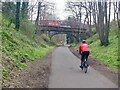
The Roseburn Path
A very helpful route in Northwest Edinburgh. Once the Caledonian Railway's route to Granton and Barnton it can get you into the West End very quickly away from the endless traffic lights on the motor roads. Dog dodging skills required.
I used the route a lot when I was working at Mary Erskine's. Another girls private school, St George's is advertised on the bridge.
Image: © Richard Webb
Taken: 27 Mar 2021
0.11 miles