
IMAGES TAKEN NEAR TO
Queensferry Street, EDINBURGH, EH2 4QS
Introduction
This page details the photographs taken nearby to Queensferry Street, EH2 4QS by members of the Geograph project.
The Geograph project started in 2005 with the aim of publishing, organising and preserving representative images for every square kilometre of Great Britain, Ireland and the Isle of Man.

There are currently over 7.5m images from over14,400 individuals and you can help contribute to the project by visiting https://www.geograph.org.uk
Image Map
Images are licensed for reuse under creativecommons.org/licenses/by-sa/2.0
Notes
- Clicking on the map will re-center to the selected point.
- The higher the marker number, the further away the image location is from the centre of the postcode.
Image Listing (988 Images Found)
Images are licensed for reuse under creativecommons.org/licenses/by-sa/2.0
Image
Details
Distance
1

Charlotte Lane
A setted street, with diners enjoying evening sunshine outside a pizza restaurant.
Image: © Stephen Craven
Taken: 7 Jun 2013
0.01 miles
2
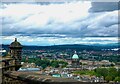
View from Edinburgh Castle
View from Edinburgh Castle looking to the northwest
Image: © Lauren
Taken: 1 Aug 2009
0.01 miles
3

Queensferry Street
The A90, looking towards its origin at Shandwick Place.
Image: © Thomas Nugent
Taken: 27 Aug 2018
0.01 miles
4

Shandwick Place
Viewed along the A90 Queensferry Street. Both prominent buildings are Category A Listed, the Rutland Hotel nearer the camera http://portal.historicenvironment.scot/designation/LB29685 and the Caledonian Hotel behind it http://portal.historicenvironment.scot/designation/LB29524 , which was built as Princes Street railway station.
Image: © Thomas Nugent
Taken: 27 Aug 2018
0.01 miles
5

Queensferry Street shops
Two cafes and a bureau de change opposite the end of Alva Street. These buildings are listed category B (ref 29576), being designed by Robert Reid in 1810.
Image: © Stephen Craven
Taken: 7 Jun 2013
0.02 miles
6

A west end fish shop
On the corner of Queensferry Street and Randolph Lane. The dome of West Register House (Charlotte Square) dominates the background.
Image: © Stanley Howe
Taken: 2 Sep 2010
0.02 miles

8

The road to Queensferry 1
This is the view from the top deck of a double-decker bus bound for Queensferry on the A90 which begins at Edinburgh's West End.
Image
Image: © kim traynor
Taken: 23 May 2012
0.03 miles

10

La P'tite Folie
A rather pretentious name for a bistro housed in a very un-Scottish mock Tudor building in Randolph Place, a short street off Queensferry Road which is saved from being a cul-de-sac by two narrow lanes and an alleyway. The food is good, however. Note that the traditional setts in the roadway have escaped being covered in tarmac. Were it not for the fading road markings and the cars and motorbikes - oh, and the inevitable over-conspicuous megawheelybin - it would look almost olde-worldy. Not a solitary TV aerial or satellite dish to be seen.
Image: © Anne Burgess
Taken: 2 Mar 2012
0.03 miles