
IMAGES TAKEN NEAR TO
Oak Place, DALKEITH, EH22 5LP
Introduction
This page details the photographs taken nearby to Oak Place, EH22 5LP by members of the Geograph project.
The Geograph project started in 2005 with the aim of publishing, organising and preserving representative images for every square kilometre of Great Britain, Ireland and the Isle of Man.

There are currently over 7.5m images from over14,400 individuals and you can help contribute to the project by visiting https://www.geograph.org.uk
Image Map
Images are licensed for reuse under creativecommons.org/licenses/by-sa/2.0
Notes
- Clicking on the map will re-center to the selected point.
- The higher the marker number, the further away the image location is from the centre of the postcode.
Image Listing (9 Images Found)
Images are licensed for reuse under creativecommons.org/licenses/by-sa/2.0
Image
Details
Distance
1
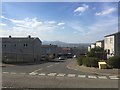
Hughes Crescent, Mayfield
View across to the Pentland Hills.
Image: © Richard Webb
Taken: 5 Apr 2019
0.09 miles
2
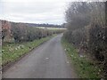
Litter strewn road, Mayfield
Worse lurks in the hedge and wood.
Image: © Richard Webb
Taken: 7 Apr 2021
0.13 miles
3
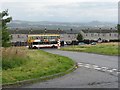
Oak Place, Mayfield
The edge of Mayfield, from the road to D'Arcy. Well served by Lothian Buses, even this far out of Edinburgh. Arthur's Seat is in the distance to the right, 12 km away.
Image: © M J Richardson
Taken: 27 Aug 2009
0.15 miles
4

View from D'Arcy
Barley in the foreground, and beyond that Mayfield and Newtongrange, with the Pentland Hills in the distance.
Image: © M J Richardson
Taken: 27 Aug 2009
0.16 miles

8
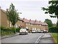
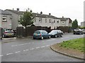
Mayfield
Houses in this large 1950's housing estate built to house miners. Now an Edinburgh dormitory. The scheme is built on a hillside and is quite high up.
Image: © Richard Webb
Taken: 11 Aug 2005
0.21 miles
9

Woodland, Mayfield
A buffer between the houses and farmland.
Image: © Richard Webb
Taken: 7 Apr 2021
0.22 miles