IMAGES TAKEN NEAR TO
Durham Place, BONNYRIGG, EH19 3ET
Introduction
This page details the photographs taken nearby to Durham Place, EH19 3ET by members of the Geograph project.
The Geograph project started in 2005 with the aim of publishing, organising and preserving representative images for every square kilometre of Great Britain, Ireland and the Isle of Man.

There are currently over 7.5m images from over14,400 individuals and you can help contribute to the project by visiting https://www.geograph.org.uk
Image Map
Images are licensed for reuse under creativecommons.org/licenses/by-sa/2.0
Notes
- Clicking on the map will re-center to the selected point.
- The higher the marker number, the further away the image location is from the centre of the postcode.
Image Listing (43 Images Found)
Images are licensed for reuse under creativecommons.org/licenses/by-sa/2.0
Image
Details
Distance
1

Cycleway, Bonnyrigg
An access point to the footpath and cycleway between Penicuik (R) and Dalkeith (L) on the route of the former railway line.
Image: © Jim Barton
Taken: 5 Feb 2015
0.09 miles
2

Path, Bonnyrigg
To the Auld Coal residential streets recently built to the south.
Image: © Richard Webb
Taken: 21 Jun 2022
0.10 miles
3
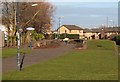
Former Bonnyrigg station
The platforms remain at the station site and the line has been converted to the Penicuik to Dalkeith footpath and cycleway. The station closed in 1962 (see Image) and at one time a short branch line led to Hopefield Colliery, now a substantial area of new housing.
Image: © Jim Barton
Taken: 5 Feb 2015
0.10 miles
4
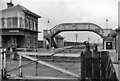
Bonnyrigg Station
View SW, towards Hawthornden; ex-NBR Edinburgh - Hawthornden Penicuik/Peebles and Galashiels lines. The line to Peebles and Galashiels was closed on 5/2/62 but the Penicuik branch lasted until 27/3/67, Bonnyrigg station having closed to passengers on 10/9/62 (10 days before this photograph), and to goods on 25/1/65.
Image: © Ben Brooksbank
Taken: 10 Sep 1962
0.11 miles

6
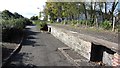
Bonnyrigg Station
Remains of a platform on the railways from Edinburgh to Galashiels, via Peebles, and Penicuik. Now a cycle and footpath.
Image: © Richard Webb
Taken: 25 Sep 2011
0.12 miles
7
Bonnyrigg Station
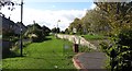
The site of Bonnyrigg station on the Peebles Railway. The station Image was closed in 1962. It is now on a very popular cycle path between Eskbank and Penicuik.
Image: © Richard Webb
Taken: 25 Sep 2011
0.13 miles
8
Cycleway crossing Dundas Street, Bonnyrigg
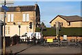
Decorative railings where the Penicuik to Dalkeith footpath and cycleway meets the B704 at Dundas Street. Note the Bonnyrigg station sign top left. The yellow sign informs that the route onwards is closed until 29th May when the alternative path network around the Borders Railway has been completed. A diversion has been signposted, though the cyclepath can still be followed as far as the footbridge over the A7 at Hardengreen.
Image: © Jim Barton
Taken: 5 Feb 2015
0.14 miles
9
Railings, Bonnyrigg Station
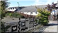
The station site is now a public open space and cycle path.
Image: © Richard Webb
Taken: 25 Sep 2011
0.14 miles