IMAGES TAKEN NEAR TO
City Road, LONDON, EC1V 1AG

Introduction

This page details the photographs taken nearby to City Road, EC1V 1AG by members of the Geograph project.

The Geograph project started in 2005 with the aim of publishing, organising and preserving representative images for every square kilometre of Great Britain, Ireland and the Isle of Man.

There are currently over 7.5m images from over14,400 individuals and you can help contribute to the project by visiting https://www.geograph.org.uk

Image Map


Images are licensed for reuse under creativecommons.org/licenses/by-sa/2.0
Notes
  • Clicking on the map will re-center to the selected point.
  • The higher the marker number, the further away the image location is from the centre of the postcode.

Image Listing (562 Images Found)

Images are licensed for reuse under creativecommons.org/licenses/by-sa/2.0
  • ...
Image
Details
Distance
1
Ventilator towers beside City Road, London EC1
Image: © Andy F Taken: 1 Feb 2010
0.00 miles
2
259 City Road under construction
These lifts ferry construction workers up and down the 15-storey building that will offer 93 'affordable' apartments when it is completed.
Image: © Stephen McKay Taken: 10 May 2011
0.01 miles
3
259 City Road under construction
A crane towers into the blue sky as it works on the construction of a 15-storey building which will contain 93 'affordable' apartments.
Image: © Stephen McKay Taken: 10 May 2011
0.01 miles
4
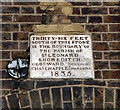
Boundary marker, near City Road
Image: © Jim Osley Taken: 28 Jun 2012
0.01 miles
5
Looking up Wharf Road
A road formerly lined with warehouses giving onto the two canal basins on either side. Those to the left, overlooking City Road Basin, are largely replaced by new housing; those on the right, overlooking Wenlock Basin, remain but are converted to flats and offices. On the extreme left, a National Grid distribution centre: the Regents Canal towpath houses a major underground power line. Visible above a window on the extreme right, a boundary stone for the parish of St Leonard Shoreditch (for details, see Image).
Image: © Christopher Hilton Taken: 14 Sep 2016
0.02 miles
6
Art galleries in Wharf Road, Hackney side
I was visiting an exhibition of abstract art by female artists in the Victoria Miro gallery, which has the two floors of a former warehouse. The exhibition continued onto the third floor above the adjoining Parasol Unit. The two share a garden with the end of Wenlock canal basin. In Wharf Road beyond the galleries are modern apartment blocks with balconies that overhang the pavement.
Image: © David Hawgood Taken: 3 May 2018
0.03 miles
7
City Road bollards
This line of bollards stands at the access point to City Road Basin from City Road itself. They look quite striking in the early spring sunshine.
Image: © Stephen McKay Taken: 16 Mar 2010
0.03 miles
8
Parish boundary stone, Micawber Street
The stone marks the southern edge of the parish of St Leonard Shoreditch, which includes much land immediately to the north and north-east of the ancient City. St Leonard is a popular dedication for churches just outside the walls of a city: he was seen as taking particular care of the sick, among others (http://sanctoral.com/en/saints/saint_leonard.html ), and leper hospitals, which were usually banished to these marginal areas, were often dedicated to him. The boundary marker can be seen in its context at Image
Image: © Christopher Hilton Taken: 14 Sep 2016
0.03 miles
9
Victoria Miro Gallery, Islington
Image: © Anthony O'Neil Taken: 4 Aug 2012
0.03 miles
10
City Road Basin reflections
The City Road Basin of the Regent's Canal is reflected in the mirror glass on the ventilator shafts above an electricity substation. The view is compressed making the basin look cavernous; this image shows how the basin actually looks: Image
Image: © Stephen McKay Taken: 5 Feb 2010
0.03 miles
  • ...