IMAGES TAKEN NEAR TO
Rosebery Avenue, LONDON, EC1R 4PT
Introduction
This page details the photographs taken nearby to Rosebery Avenue, EC1R 4PT by members of the Geograph project.
The Geograph project started in 2005 with the aim of publishing, organising and preserving representative images for every square kilometre of Great Britain, Ireland and the Isle of Man.

There are currently over 7.5m images from over14,400 individuals and you can help contribute to the project by visiting https://www.geograph.org.uk
Image Map
Images are licensed for reuse under creativecommons.org/licenses/by-sa/2.0
Notes
- Clicking on the map will re-center to the selected point.
- The higher the marker number, the further away the image location is from the centre of the postcode.
Image Listing (878 Images Found)
Images are licensed for reuse under creativecommons.org/licenses/by-sa/2.0
Image
Details
Distance
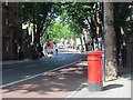
1
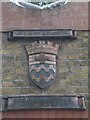
Rosebery Avenue School plaque, Rosebery Avenue EC1
Image: © Robin Sones
Taken: 23 Jun 2009
0.01 miles
2
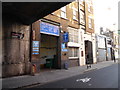
A walk from Clerkenwell to Piccadilly (61)
Clerkenwell Motors, Warner Street
(virtually under the Rosebery Avenue Bridge)
Image: © Basher Eyre
Taken: 21 Feb 2019
0.01 miles
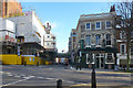
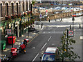
3
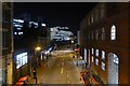
Warner Street
Looking down on Warner Street from Rosebery Avenue.
Image: © DS Pugh
Taken: 8 Dec 2017
0.02 miles
4
Warner Street EC1
Looking towards the junction with Mount Pleasant EC1. Taken from the Rosebery Avenue bridge
Image: © Robin Sones
Taken: 23 Jun 2009
0.02 miles
5
A walk from Clerkenwell to Piccadilly (62)
Approaching The Apple Tree, Mount Pleasant https://pubshistory.com/LondonPubs/Clerkenwell/AppleTree.shtml
Image: © Basher Eyre
Taken: 21 Feb 2019
0.02 miles
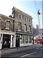
6
The Apple Tree, Clerkenwell
Greene King pub on the corner of Warner street and Mount Pleasant.
Image: © Stephen McKay
Taken: 4 Oct 2012
0.02 miles
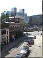
7
The Apple Tree and a 19th century flyover
Down Warner Street, EC1, Rosebury Avenue crosses via a bridge built in 1890. It is a grade II listed building, as is the pub on the corner.
Image: © Robin Webster
Taken: 21 Nov 2015
0.02 miles
8
Looking along Warner Street. Clerkenwell
Warner Street, running along the bottom of a valley, marks the line of the culverted River Fleet. The bridge in the distance (carrying Rosebery Avenue) indicates the shape of the land. The boundary between the London Boroughs of Islington and Camden follows the long-buried river, perpetuating much older parish boundaries.
Image: © Christopher Hilton
Taken: 9 Mar 2018
0.02 miles
10
Warner Street, Clerkenwell
Looking down from the Rosebery Avenue viaduct to Warner Street and its junction with Mount Pleasant. The boundary between the boroughs of Islington (to the right) and Camden (to the left) runs along this street. The Apple Tree pub is on the left.
Image: © Stephen McKay
Taken: 4 Oct 2012
0.02 miles