IMAGES TAKEN NEAR TO
Victoria Park, LONDON, E9 5DU
Introduction
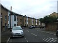
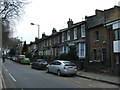
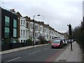
This page details the photographs taken nearby to Victoria Park, E9 5DU by members of the Geograph project.
The Geograph project started in 2005 with the aim of publishing, organising and preserving representative images for every square kilometre of Great Britain, Ireland and the Isle of Man.

There are currently over 7.5m images from over14,400 individuals and you can help contribute to the project by visiting https://www.geograph.org.uk
Image Map (Loading...)


Getting Data...Please wait
Leaflet Map data © OpenStreetMap
Images are licensed for reuse under creativecommons.org/licenses/by-sa/2.0
Notes
- Clicking on the map will re-center to the selected point.
- The higher the marker number, the further away the image location is from the centre of the postcode.
Image Listing (104 Images Found)
Images are licensed for reuse under creativecommons.org/licenses/by-sa/2.0
Image
Details
Distance

6

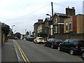
New houses on Cadogan Terrace, Hackney
These were built within the last year or two of taking this in 2012
Image: © David Howard
Taken: 11 Jul 2012
0.08 miles