
IMAGES TAKEN NEAR TO
Earlham Grove, LONDON, E7 9AP
Introduction
This page details the photographs taken nearby to Earlham Grove, E7 9AP by members of the Geograph project.
The Geograph project started in 2005 with the aim of publishing, organising and preserving representative images for every square kilometre of Great Britain, Ireland and the Isle of Man.

There are currently over 7.5m images from over14,400 individuals and you can help contribute to the project by visiting https://www.geograph.org.uk
Image Map
Images are licensed for reuse under creativecommons.org/licenses/by-sa/2.0
Notes
- Clicking on the map will re-center to the selected point.
- The higher the marker number, the further away the image location is from the centre of the postcode.
Image Listing (58 Images Found)
Images are licensed for reuse under creativecommons.org/licenses/by-sa/2.0
Image
Details
Distance
1

09:30 from Liverpool Street non-stop at Forest Gate
Headed by driving van trailer 82 143, the final destination is Norwich.
Image: © Robin Webster
Taken: 2 Apr 2011
0.06 miles
2
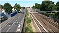
Road and rail near Forest Gate station
Image: © David Martin
Taken: 10 Jul 2015
0.07 miles
3
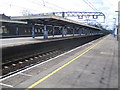
Forest Gate railway station
This grid square is unusual in having two completely separate Network Rail stations in it. This is Forest Gate on the Liverpool Street to Shenfield line, looking in the direction of the former.
Image: © Nigel Cox
Taken: 7 Mar 2007
0.08 miles
4
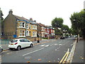
Earlham Grove, near Forest Gate
Earlham Grove is a tree-lined residential road near Forest Gate, in the east London suburbs.
Image: © Malc McDonald
Taken: 3 Sep 2017
0.09 miles
5
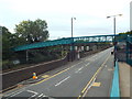
Bridge over Forest lane, near Forest Gate
This footbridge crosses Forest Lane, and the railway line immediately adjacent.
The railway forms part of the Great Eastern Main Line, linking London with Colchester, Ipswich and Norwich.
Image: © Malc McDonald
Taken: 3 Sep 2017
0.10 miles
6
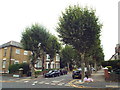
Norwich Road, near Forest Gate
Norwich Road is a tree-lined residential road near Forest Gate, in the suburbs of east London.
Image: © Malc McDonald
Taken: 3 Sep 2017
0.10 miles
7
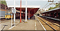
Forest Gate Station, 1991
View eastward, towards Ilford, Shenfield and the East: ex-GER London Liverpool Street - Shenfield - Chelmsford - Colchester - Ipswich - Norwich etc. main line; all electrified - since 1946 to Shenfield. At the Up Local line platform is a Class 312 EMU.
Image: © Ben Brooksbank
Taken: 16 Aug 1991
0.11 miles
9
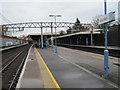
Forest Gate railway station, Greater London, 2012
Opened in 1839 by the Eastern Counties Railway on the line from London to Shenfield.
View east towards Manor Park and Shenfield. See Image for the view six years later from a similar camera position.
Image: © Nigel Thompson
Taken: 19 Jan 2012
0.12 miles
10
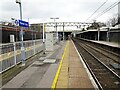
Forest Gate railway station, Greater London
Opened in 1839 by the Eastern Counties Railway on the line from London to Shenfield.
View east towards Manor Park and Shenfield. In the six years since Image was taken from a similar position, new platform railings and Transport for London signage has appeared, as well as new footsteps and lifts (in the distance).
Image: © Nigel Thompson
Taken: 13 Mar 2018
0.12 miles