
IMAGES TAKEN NEAR TO
Geldeston Road, LONDON, E5 8RT
Introduction
This page details the photographs taken nearby to Geldeston Road, E5 8RT by members of the Geograph project.
The Geograph project started in 2005 with the aim of publishing, organising and preserving representative images for every square kilometre of Great Britain, Ireland and the Isle of Man.

There are currently over 7.5m images from over14,400 individuals and you can help contribute to the project by visiting https://www.geograph.org.uk
Image Map
Images are licensed for reuse under creativecommons.org/licenses/by-sa/2.0
Notes
- Clicking on the map will re-center to the selected point.
- The higher the marker number, the further away the image location is from the centre of the postcode.
Image Listing (71 Images Found)
Images are licensed for reuse under creativecommons.org/licenses/by-sa/2.0
Image
Details
Distance
1
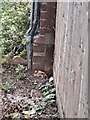
Chedworth House, Geldeston Road, Benchmark
Image: © Cipollini
Taken: 14 Jul 2024
0.02 miles
2
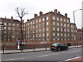
Flats on Upper Clapton Road, Hackney
There are large estates of flats around here. View west across Upper Clapton Road to Wensdale House.
Image: © David Hawgood
Taken: 17 Mar 2006
0.07 miles
3
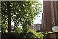
Housing estate on Cazenove Road, Clapton
Image: © David Howard
Taken: 25 Jun 2024
0.09 miles
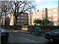
5
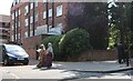
Housing estate on Cazenove Road, Clapton
Image: © David Howard
Taken: 25 Jun 2024
0.10 miles
6
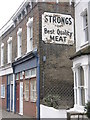
Strongs best quality meat
Advert for a long-forgotten brand (and shop), Stoke Newington, London.
Image: © Dave Pickersgill
Taken: 30 Dec 2011
0.11 miles

8
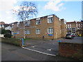
Fountayne Road Health Centre, Stoke Newington
Fountayne Road Heath Centre in Stoke Newington, in inner north east London.
Image: © Malc McDonald
Taken: 1 Feb 2020
0.12 miles
9
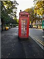
Phone box on Cazenove Road, Stamford Hill
Image: © David Howard
Taken: 3 Oct 2021
0.12 miles
10
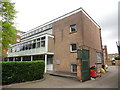
Clapton Telephone Exchange (1)
Situated in Upper Clapton Road, this TE dates from 1960 as indicated by EIIR 1960 on the building. It serves Upper Clapton and used to have UPPer Clapton numbers until the late 1960s. A red rubbish bin and a yellow grit salt bin can be seen at the side of the TE whilst a lime tree can just be seen to the left of the photo.
Image: © David Hillas
Taken: 22 Apr 2017
0.12 miles