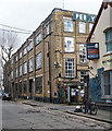
IMAGES TAKEN NEAR TO
Hart Yard, LONDON, E3 2FW

Introduction

This page details the photographs taken nearby to Hart Yard, E3 2FW by members of the Geograph project.

The Geograph project started in 2005 with the aim of publishing, organising and preserving representative images for every square kilometre of Great Britain, Ireland and the Isle of Man.

There are currently over 7.5m images from over14,400 individuals and you can help contribute to the project by visiting https://www.geograph.org.uk

Image Map


Images are licensed for reuse under creativecommons.org/licenses/by-sa/2.0
Notes
  • Clicking on the map will re-center to the selected point.
  • The higher the marker number, the further away the image location is from the centre of the postcode.

Image Listing (367 Images Found)

Images are licensed for reuse under creativecommons.org/licenses/by-sa/2.0
  • ...
Image
Details
Distance
1
The Greenway
Image: © N Chadwick Taken: 21 Oct 2012
0.01 miles
2
The Greenway, looking east
Image: © Rob Purvis Taken: 29 May 2023
0.03 miles
3
Dace Road, Fish Island
Image: © Chris Whippet Taken: 25 Jan 2015
0.04 miles
4
Northern Outfall Sewer, Blue Plaque
Image: © N Chadwick Taken: 21 Oct 2012
0.04 miles
5
Dace Road, near Hackney Wick
The buildings in the foreground are doubtlessly former warehouses, located close to the River Lee. The Olympic Stadium is visible over the rooftops.
Image: © Malc McDonald Taken: 25 May 2013
0.04 miles
6
Greenway near the Olympic Park
The Greenway is a walking and cycling route leading into the Queen Elizabeth Olympic Park in East London.
Image: © Malc McDonald Taken: 25 May 2013
0.04 miles
7
Roundabout on Wick Lane
As seen from Crown Close. In the background is the top of the new Olympic Stadium in Olympic Park. On the right, the ArcelorMittal Orbit (viewing tower within the Olympic Park) can just be seen.
Image: © David Anstiss Taken: 15 Feb 2012
0.04 miles
8
Former warehouse, Fish Island, Hackney Wick
Once the premises of Percy Dalton's Famous Peanut Company.
Image: © Jim Osley Taken: 2 Feb 2018
0.04 miles
9
Steps up to The Greenway
This is the view from Dace Road. The steps lead up to The Greenway which runs along the top of the Northern Outfall Sewer.
Image: © Marathon Taken: 28 May 2014
0.05 miles
10
View of a wall of street art on Dace Road
Looking south-southwest.
Image: © Robert Lamb Taken: 29 Aug 2020
0.05 miles
  • ...