
IMAGES TAKEN NEAR TO
Chambord Street, LONDON, E2 7LP
Introduction
This page details the photographs taken nearby to Chambord Street, E2 7LP by members of the Geograph project.
The Geograph project started in 2005 with the aim of publishing, organising and preserving representative images for every square kilometre of Great Britain, Ireland and the Isle of Man.

There are currently over 7.5m images from over14,400 individuals and you can help contribute to the project by visiting https://www.geograph.org.uk
Image Map
Images are licensed for reuse under creativecommons.org/licenses/by-sa/2.0
Notes
- Clicking on the map will re-center to the selected point.
- The higher the marker number, the further away the image location is from the centre of the postcode.
Image Listing (647 Images Found)
Images are licensed for reuse under creativecommons.org/licenses/by-sa/2.0
Image
Details
Distance
2

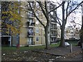
Columbia Road Flower market on a wet Sunday
Despite the damp weather, the market traders were still doing a good trade selling plants and flowers in the Columbia Road Street Market in Hoxton on this May morning. It's become an important and colourful part of the East End Market scene
Image: © David Williams
Taken: 21 May 2006
0.05 miles
3
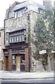
18th Century weaver's house, Brick Lane, East London, Circa 1980
Corner of what is now Brick Lane and Swanfield Street. Pictured before the area was developed in the 90s. Note the extra large windows to admit as much light as possible. For a view of what it looks like now, and to see how that tree has grown, go to https://www.google.co.uk/maps/@51.5262726,-0.0733078,3a,75y,55.37h,94.34t/data=!3m6!1e1!3m4!1sUxB7qziqXDnsVsduhIGKqg!2e0!7i13312!8i6656?hl=en
Image: © Derek Voller
Taken: Unknown
0.05 miles
4
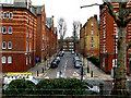
Bethnal Green: Palissy Street from Arnold Circus
This short street terminates at a T-junction with Swanfield Street (earlier name of this was Mount Street).
Image: © Dr Neil Clifton
Taken: 3 Feb 2010
0.07 miles
6
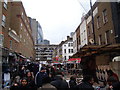
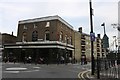
View of the Gherkin and buildings on Middlesex Street from Petticoat Lane Market
This is the view in the opposite direction to Image, taking looking south-southwest from Wentworth Street, showing the blocks of flats on Middlesex Street and the Gherkin towering above those.
Image: © Robert Lamb
Taken: 7 Feb 2010
0.08 miles
7
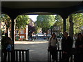
View up Rochelle Street from the pagoda on Arnold Circus
Looking east-southeast.
Image: © Robert Lamb
Taken: 21 Oct 2011
0.08 miles
8
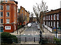
Bethnal Green: Rochelle Street from Arnold Circus
Rochelle Street runs southeast from Arnold Circus to a T-junction with Swanfield Street, (whose previous name was Mount Street).
Image: © Dr Neil Clifton
Taken: 3 Feb 2010
0.08 miles
9
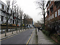
Bethnal Green: Virginia Road, looking east
Taken from the northern end of Hocker Street. Virginia Road (earlier, Virginia Row) once extended in a straight line to a junction with Columbia road, but at the far end the street pattern has changed, and the present-day Virginia Road bends northwards at the east end, to make a T-junction with Columbia Road
Image: © Dr Neil Clifton
Taken: 3 Feb 2010
0.08 miles
10
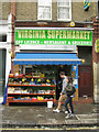
Neighbourhood shop, Virginia Road E2
Open at Sunday lunchtime, Virginia Supermarket takes its name from the road.
Image: © Robin Stott
Taken: 10 Jun 2012
0.08 miles