
IMAGES TAKEN NEAR TO
Wellington Row, LONDON, E2 7BB
Introduction
This page details the photographs taken nearby to Wellington Row, E2 7BB by members of the Geograph project.
The Geograph project started in 2005 with the aim of publishing, organising and preserving representative images for every square kilometre of Great Britain, Ireland and the Isle of Man.

There are currently over 7.5m images from over14,400 individuals and you can help contribute to the project by visiting https://www.geograph.org.uk
Image Map
Images are licensed for reuse under creativecommons.org/licenses/by-sa/2.0
Notes
- Clicking on the map will re-center to the selected point.
- The higher the marker number, the further away the image location is from the centre of the postcode.
Image Listing (224 Images Found)
Images are licensed for reuse under creativecommons.org/licenses/by-sa/2.0
Image
Details
Distance
1
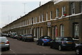
Quilter Street, E2
An area where nineteenth-century terraces largely survive, in contrast to the local authority housing estates around them. These have been thoroughly gentrified.
Image: © Christopher Hilton
Taken: 18 May 2012
0.02 miles
2
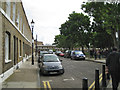
Elwin Street and Jesus Green E2
Behind the bustle of Columbia Road is this calm low-rise square around a pleasant green.
Image: © Robin Stott
Taken: 10 Jun 2012
0.04 miles
4
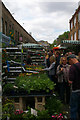
Sunday morning at Columbia Road Flower Market (3)
Image: © Jim Osley
Taken: 15 May 2011
0.05 miles
5
Sunday morning at Columbia Road Flower Market (4)
Image: © Jim Osley
Taken: 15 May 2011
0.05 miles
6
View of Columbia Road shops from Columbia Road
Looking north-northeast. Yes, the pavement really is that narrow in front of the houses - you have to straddle the bars when people want to come past you! Why this has been done, I don't know, but it certainly doesn't stop people walking in the front gardens of those houses, if that's what the bars are supposed to prevent!
Image: © Robert Lamb
Taken: 9 Jan 2011
0.05 miles
7
Baxendale Street and Barnet Grove E2
Baxendale Street is on the left; seen from the junction with Columbia Road.
Image: © Robin Stott
Taken: 29 Nov 2009
0.05 miles
8
Columbia Road E2, shops and market
The north-east end of the Sunday flower market.
Image: © Robin Stott
Taken: 29 Nov 2009
0.05 miles
9
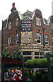
"The Royal Oak" public house, Columbia Road
In foreground of the image are Columbia Road Flower Market stalls. The market is held every Sunday and is a magnet for gardeners and those seeking cut flowers.
Image: © Jim Osley
Taken: 15 May 2011
0.05 miles
10
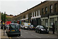
Columbia Road, E2
An area where nineteenth-century terraces largely survive, in contrast to the local authority housing estates around them.
Image: © Christopher Hilton
Taken: 18 May 2012
0.05 miles