
IMAGES TAKEN NEAR TO
Hare Marsh, LONDON, E2 6FF
Introduction
This page details the photographs taken nearby to Hare Marsh, E2 6FF by members of the Geograph project.
The Geograph project started in 2005 with the aim of publishing, organising and preserving representative images for every square kilometre of Great Britain, Ireland and the Isle of Man.

There are currently over 7.5m images from over14,400 individuals and you can help contribute to the project by visiting https://www.geograph.org.uk
Image Map
Images are licensed for reuse under creativecommons.org/licenses/by-sa/2.0
Notes
- Clicking on the map will re-center to the selected point.
- The higher the marker number, the further away the image location is from the centre of the postcode.
Image Listing (738 Images Found)
Images are licensed for reuse under creativecommons.org/licenses/by-sa/2.0
Image
Details
Distance
1
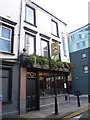
The Carpenters' Arms seen from St Matthew's Row
The Carpenters' Arms was bought by the Kray twins in the autumn of 1967. They needed their own safe place in which to drink, and from where they could issue orders. This local pub fitted the bill perfectly. It had a narrow bar and one doorway to the road so nobody could get in unobserved. It was from here they set out to kill Jack "the Hat" McVitie on 28th October 1967.
It is still a pub but appears to have gone somewhat upmarket since the arrest of the Krays in 1968.
Image: © Marathon
Taken: 10 Jan 2014
0.01 miles
2
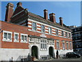
The Bath House, Cheshire Street
Once a public bathing facility, an essential amenity when many dwellings had no internal bathroom. Now it is home to an amateur boxing club http://www.reptonboxingclub.com/ , another important amenity in an area with higher than average youth unemployment and social exclusion.
Image: © Danny P Robinson
Taken: 9 Apr 2007
0.01 miles
5
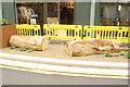
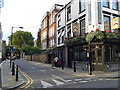
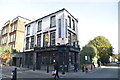
View of ornamental tree trunks on Cheshire Street
Cheshire Street seems to be undergoing a bit of a makeover, with the pavement being extended outwards and these tree trunks (presumably for sitting on) being added. New heritage-style streetlighting has also been installed. Looking south-southeast.
Image: © Robert Lamb
Taken: 10 Jul 2021
0.02 miles
6
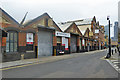
Premises on Cheshire Street, E2
Seven bays of a nine bay building, four of which to the right are two storey. Depending how old it is, it may be a railway building dating from before the building of Liverpool Street and its approaches in the 1860s, It is certainly on the site of one. The upper level would be on the level of the viaduct into the old Bishopsgate terminus. Street level could have been accessed via wagon lifts and tracks passing under the viaduct arches, but the Liverpool Street approaches would have severed these as the new tracks ramp up from below street level to viaduct level.
Image: © Robin Webster
Taken: 6 Apr 2019
0.03 miles
7
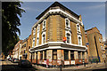
Former King & Queen
Former King & Queen pub at 89 Cheshire Street E2. It closed in 1996 and was converted to residential use, though today looks empty and derelict
Image: © Richard Croft
Taken: 24 Jul 2019
0.03 miles
8
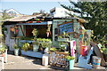
View of Shoreditch Greens in the Nomadic Community Gardens
Looking north-northwest.
Image: © Robert Lamb
Taken: 1 Sep 2018
0.04 miles
9
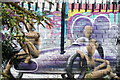
View of street art in the Nomadic Community Garden #2
Looking north-northeast.
Image: © Robert Lamb
Taken: 1 Sep 2018
0.04 miles
10
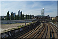
Three Colts Corner to the City
View from the footbridge at Three Colts Corner, Shoreditch over the Great Eastern Mainline running into Liverpool Street Station. 201 Bishopsgate can be seen on the right. Heron Tower and the "Gherkin" (slightly obscured) on the left.
Image: © Rob Rogers
Taken: 22 Sep 2010
0.04 miles