IMAGES TAKEN NEAR TO
Liberty Bridge Road, LONDON, E20 1AN

Introduction

This page details the photographs taken nearby to Liberty Bridge Road, E20 1AN by members of the Geograph project.

The Geograph project started in 2005 with the aim of publishing, organising and preserving representative images for every square kilometre of Great Britain, Ireland and the Isle of Man.

There are currently over 7.5m images from over14,400 individuals and you can help contribute to the project by visiting https://www.geograph.org.uk

Image Map


Images are licensed for reuse under creativecommons.org/licenses/by-sa/2.0
Notes
  • Clicking on the map will re-center to the selected point.
  • The higher the marker number, the further away the image location is from the centre of the postcode.

Image Listing (200 Images Found)

Images are licensed for reuse under creativecommons.org/licenses/by-sa/2.0
  • ...
Image
Details
Distance
1
Balconies at Mira House
Image: © Oast House Archive Taken: 2 Aug 2020
0.03 miles
2
Liberty Bridge Rd, London E20
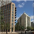
This road cuts through part of the former Athletes' Village which is in the process of being transformed into East Village. The buildings are Vesta House (centre left), Mimosa House (centre right) and the currently disused Polyclinic (right).
Image: © David Kemp Taken: 18 Sep 2013
0.03 miles
3
Balconies at Mira House
Image: © Oast House Archive Taken: 2 Aug 2020
0.03 miles
4
Mira and Mimosa House
Image: © Oast House Archive Taken: 2 Aug 2020
0.03 miles
5
Apartment blocks, Celebration Avenue
Vesta House on the right at Liberty Bridge junction.
Image: © Oast House Archive Taken: 2 Aug 2020
0.04 miles
6
Celebration Avenue, London E20
Celebration Avenue runs through the former Olympic Athletes' Village which is in the process of being transformed into a residential area. The block nearest the bus is Vesta House.
Image: © David Kemp Taken: 18 Sep 2013
0.04 miles
7
New apartment block, Celebration Avenue
Image: © Oast House Archive Taken: 2 Aug 2020
0.04 miles
8
Celebration Avenue
A comparison with Image shows what has changed since April 2018.
Image: © John Baker Taken: 26 Sep 2018
0.05 miles
9
Victory Park
An open space in East Village viewed at dusk. None of the maps show the current layout of this area.
Image: © Bill Boaden Taken: 9 Oct 2015
0.05 miles
10
Apartment blocks at Stratford
Viewed as daylight is fading.
Image: © Bill Boaden Taken: 9 Oct 2015
0.05 miles
  • ...