
IMAGES TAKEN NEAR TO
Gowers Walk, LONDON, E1 8PY
Introduction
This page details the photographs taken nearby to Gowers Walk, E1 8PY by members of the Geograph project.
The Geograph project started in 2005 with the aim of publishing, organising and preserving representative images for every square kilometre of Great Britain, Ireland and the Isle of Man.

There are currently over 7.5m images from over14,400 individuals and you can help contribute to the project by visiting https://www.geograph.org.uk
Image Map
Images are licensed for reuse under creativecommons.org/licenses/by-sa/2.0
Notes
- Clicking on the map will re-center to the selected point.
- The higher the marker number, the further away the image location is from the centre of the postcode.
Image Listing (368 Images Found)
Images are licensed for reuse under creativecommons.org/licenses/by-sa/2.0
Image
Details
Distance
1
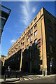
Former warehouse, Gower's Walk, Whitechapel
This building with craens mounted high on the wall is clearly a former warehouse now converted to accommodation.
Image: © Chris Allen
Taken: 21 Aug 2011
0.02 miles
2
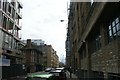
View down Back Church Lane #2
I have continued the numbering system from my previous shot. Looking south.
Image: © Robert Lamb
Taken: 20 Mar 2016
0.02 miles
3
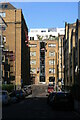
Hooper Street, Whitechapel
This area includes former warehouses converted to accommodation as well as a former hydraulic power station.
Image: © Chris Allen
Taken: 21 Aug 2011
0.03 miles
4
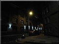
Back Church Lane at the corner of Hooper Street
Old warehouses no doubt being used for offices now.
Image: © David Howard
Taken: 24 Jun 2013
0.03 miles
5
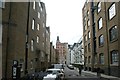
View along Hooper Street from Back Church Lane
Looking west.
Image: © Robert Lamb
Taken: 20 Mar 2016
0.04 miles
6
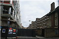
View along Boyd Street from Back Church Lane
Looking east.
Image: © Robert Lamb
Taken: 20 Mar 2016
0.04 miles
7
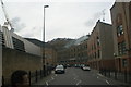
View down Back Church Lane
Looking south-southwest.
Image: © Robert Lamb
Taken: 13 Sep 2015
0.04 miles
9
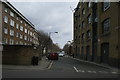
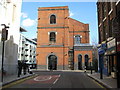
View along Ellen Street from Back Church Lane
Looking east.
Image: © Robert Lamb
Taken: 20 Mar 2016
0.05 miles
10
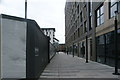
View of the path leading out of the Goodmans Fields housing development
Looking south-southeast.
Image: © Robert Lamb
Taken: 20 Mar 2016
0.05 miles