
IMAGES TAKEN NEAR TO
Wentworth Street, LONDON, E1 7BB
Introduction
This page details the photographs taken nearby to Wentworth Street, E1 7BB by members of the Geograph project.
The Geograph project started in 2005 with the aim of publishing, organising and preserving representative images for every square kilometre of Great Britain, Ireland and the Isle of Man.

There are currently over 7.5m images from over14,400 individuals and you can help contribute to the project by visiting https://www.geograph.org.uk
Image Map
Images are licensed for reuse under creativecommons.org/licenses/by-sa/2.0
Notes
- Clicking on the map will re-center to the selected point.
- The higher the marker number, the further away the image location is from the centre of the postcode.
Image Listing (1498 Images Found)
Images are licensed for reuse under creativecommons.org/licenses/by-sa/2.0
Image
Details
Distance
2
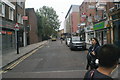
View up Old Montague Street from Brick Lane
Looking north-northeast.
Image: © Robert Lamb
Taken: 13 Sep 2015
0.01 miles
3
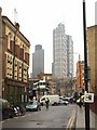
Wentworth Street, E1
The traffic ahead is on Commercial Street, beyond which Wentworth Street continues into Petticoat Lane market.
Image: © Derek Harper
Taken: 1 Feb 2011
0.01 miles
5
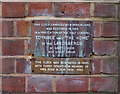
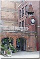
Aldgate : Toynbee Hall clock tower plaque
Image: © Jim Osley
Taken: 10 Jul 2020
0.02 miles
6

Aldgate : Toynbee Hall
Grade II listed building from 1884 - historicengland.org.uk/listing/the-list/list-entry/1065201. Architect: Elijah Hoole. See also this https://blogs.ucl.ac.uk/survey-of-london/tag/elijah-hoole/.
Image: © Jim Osley
Taken: 10 Jul 2020
0.02 miles
7
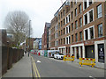
Wentworth Street, E1
East of Commercial Street.
Image: © Robin Webster
Taken: 6 Apr 2019
0.02 miles
8
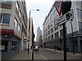
New building, viewed from Osborn Street
This building has only recently started being renovated, as the Google Streetview of this location http://www.google.co.uk/maps?f=q&source=s_q&hl=en&geocode=&q=wentworth+street,+e1&sll=51.516808,-0.066519&sspn=0.011537,0.027423&ie=UTF8&hq=&hnear=Wentworth+St,+London+E1,+United+Kingdom&ll=51.517289,-0.072441&spn=0.004914,0.027423&z=15&layer=c&cbll=51.517299,-0.070548&panoid=kpSC8Z3P8E8QJ8Z5iFHrBQ&cbp=11,257.73,,2,-8.38 shows the building in its former state. This view has been taken from the junction of Wentworth Street (pictured), Osborn Street (behind the photographer to the left) and Brick Lane (just to the right of the photographer) looking west.
Image: © Robert Lamb
Taken: 7 Feb 2010
0.02 miles
9
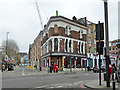
The Culpeper, Commercial Street, E1
At the crossing with Wentworth Street.
Image: © Robin Webster
Taken: 6 Apr 2019
0.02 miles
10
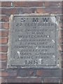
Old Boundary Marker by Wentworth Street, Stepney Parish
Parish Boundary Marker by the UC road, in parish of Stepney (Tower Hamlets District), Wentworth Street E1, wall of Princess Alice PH at junction with Commercial Street, high on wall.
Surveyed
Milestone Society National ID: MX_SMWL02pb
Image: © Milestone Society
Taken: Unknown
0.02 miles