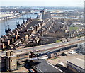
IMAGES TAKEN NEAR TO
Dock Road, LONDON, E16 1YZ

Introduction

This page details the photographs taken nearby to Dock Road, E16 1YZ by members of the Geograph project.

The Geograph project started in 2005 with the aim of publishing, organising and preserving representative images for every square kilometre of Great Britain, Ireland and the Isle of Man.

There are currently over 7.5m images from over14,400 individuals and you can help contribute to the project by visiting https://www.geograph.org.uk

Image Map


Images are licensed for reuse under creativecommons.org/licenses/by-sa/2.0
Notes
  • Clicking on the map will re-center to the selected point.
  • The higher the marker number, the further away the image location is from the centre of the postcode.

Image Listing (544 Images Found)

Images are licensed for reuse under creativecommons.org/licenses/by-sa/2.0
  • ...
Image
Details
Distance
1
Docklands Light Railway
Image: © N Chadwick Taken: 11 Jan 2018
0.01 miles
2
View from Emirates Air line
Image: © N Chadwick Taken: 1 Jul 2017
0.01 miles
3
Royal Victoria Dock Vicinity, London, E16
Britannia Gateway can be picked out as the first left-hand turning off this stretch of the A1020 (a.k.a. Silvertown Way). Further into this new-build estate, Wesley Avenue can be seen disappearing towards three tower-blocks in Britannia Village. Beyond these three tall buildings, London City Airport's single runway is visible. The four pairs of now-redundant quayside cranes are situated on Royal Wharf opposite the EXCEL Conference Centre (identifiable courtesy of its metal roof struts). The two sides of the dock are linked by the Royal Victoria Dock Bridge, an elevated footbridge behind the most distant crane.
Image: © David Hallam-Jones Taken: 2 Apr 2016
0.02 miles
4
Cable car pylon
The northern pylon of the Thames cable car crossing. See Image for context.
Image: © Stephen Craven Taken: 19 Feb 2012
0.04 miles
5
Cable car pylon
The northern pylon of the Thames cable car crossing (to be known by its sponsor as the Emirates Air Line) already complete while the southern one was still under construction Image Viewed from across the Thames with moored small boats in the foreground.
Image: © Stephen Craven Taken: 19 Feb 2012
0.04 miles
6
Mixed land use
This view from the Emirates Airline cable car shows, in a small part of this grid square, uses including car parking, construction plant depot, offices, DLR line, housing and watersports (on the former Royal Victoria Dock)
Image: © Stephen Craven Taken: 12 Jan 2013
0.04 miles
7
Apartments, Royal Victoria Dock
Image: © N Chadwick Taken: 26 May 2012
0.04 miles
8
Western Beach Apartments and the Royal Victoria Dock
Seen from the IFS Cloud cable car.
Image: © Chris Allen Taken: 19 Jul 2023
0.05 miles
9
Apartments, Victoria Docks
Image: © N Chadwick Taken: 29 Nov 2018
0.05 miles
10
Nuplex Resins
One of several industrial sites along North Woolwich Road, in an area that has only recently become a tourist destination with the redevelopment of the Royal Docks. This one has a slightly more attractive entrance building than most. Viewed underneath the DLR viaduct.
Image: © Stephen Craven Taken: 30 Jun 2012
0.05 miles
  • ...