IMAGES TAKEN NEAR TO
Buxton Road, LONDON, E15 1QX
Introduction
This page details the photographs taken nearby to Buxton Road, E15 1QX by members of the Geograph project.
The Geograph project started in 2005 with the aim of publishing, organising and preserving representative images for every square kilometre of Great Britain, Ireland and the Isle of Man.

There are currently over 7.5m images from over14,400 individuals and you can help contribute to the project by visiting https://www.geograph.org.uk
Image Map
Images are licensed for reuse under creativecommons.org/licenses/by-sa/2.0
Notes
- Clicking on the map will re-center to the selected point.
- The higher the marker number, the further away the image location is from the centre of the postcode.
Image Listing (39 Images Found)
Images are licensed for reuse under creativecommons.org/licenses/by-sa/2.0
Image
Details
Distance
1
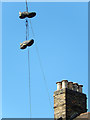
Trainers on a wire
Quite what this pair of trainers was doing hanging from a telephone wire above Maryland Square is anybody's guess. It will no doubt be more difficult to get them down than it was to get them up there.
Image: © Stephen McKay
Taken: 1 Oct 2015
0.09 miles
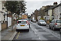
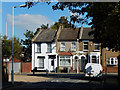
3
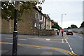
Maryland Square
A quiet corner of Stratford, conveniently close to Maryland station.
Image: © Stephen McKay
Taken: 1 Oct 2015
0.10 miles
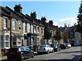
5
Bow Street, Maryland
The end of Bow Street; the houses ahead are on Maryland Park.
Image: © Stephen McKay
Taken: 1 Oct 2015
0.13 miles
6
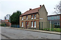
31A Maryland Park, E15
A house within the grounds of St. Francis Catholic Primary School.
Image: © Robin Webster
Taken: 29 Jan 2011
0.14 miles
7
St. Francis Catholic Primary School
Viewed from Bow Street through a rather high fence.
Image: © Robin Webster
Taken: 29 Jan 2011
0.16 miles
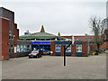
8
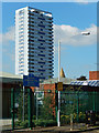
St Francis Catholic Primary School, Maryland Park
The school dates from 1816 when a school for Catholic children was set up in Stratford High Street. The present site in Maryland Park has been used since the 1970s. It is overlooked by Henniker Point.
Image: © Stephen McKay
Taken: 1 Oct 2015
0.16 miles
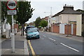
10
End of Thorogood Gardens
A path continues through to Forest Lane.
Image: © Robin Webster
Taken: 29 Jan 2011
0.17 miles