1
London skyline from Sir Christopher France House, Queen Mary University
This is a view of the London skyline from one of the student residences, Sir Christopher France House, of Queen Mary University, taken using my new LG BL20 camera phone looking southwest. You can certainly notice the difference between the quality of the photos taken using this phone to my old Nokia phone - neither are nowhere near as good as my large Sony digital camera though!
Image: © Robert Lamb
Taken: 7 Mar 2010
0.02 miles
2
Department of Chemistry, Queen Mary College
Image: © John Winfield
Taken: 13 Oct 2007
0.03 miles
3
View of the Queens Building from the student village
This is the Queens Building, the oldest building in Queen Mary University, constructed in the 1930s after the original building caught fire in 1931. It was then known as St Helen's Terrace, a row of six houses neighbouring the original site of the Queens Building. View taken looking across the car park from the 'student village'.
Image: © Robert Lamb
Taken: 26 Oct 2009
0.05 miles
4
Snow-covered Jewish Cemetery on Queen Mary, University of London Mile End Campus
Looking south-southeast.
Image: © Robert Lamb
Taken: 2 Dec 2010
0.07 miles
5
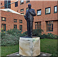
Attlee statue, Mile End Road
Statues of Clement Attlee are surprisingly hard to come by. The large plinth records only his name and dates (1883-1967), but on the wall behind (just right of shot) is an informative plaque, which should be better sited. The statue, by Frank Forster, was unveiled by Harold Wilson in 1988 in Limehouse before being moved to its present location, on the campus of Queen Mary University of London, in 2011. Attlee was a local mayor and M.P., and was at the nearby Great Hall in 1945 when he heard that he had won the election.
Image: © Stephen Richards
Taken: 21 Jan 2019
0.07 miles
6
Student accommodation beside the Regent's Canal
View from hillock in Mile End Park, just above Mile End lock.
Image: © Natasha Ceridwen de Chroustchoff
Taken: 4 Oct 2009
0.08 miles
7
View SW from mound in Mile End Park
From an artificial mound giving good all-round views. In this case, towards the campus of Queen Mary University of London.
Image: © Robin Webster
Taken: 6 Apr 2019
0.09 miles
8
Westfield Student Village, Mile End
Just one of the new student buildings at Queen Mary College
Image: © John Winfield
Taken: 13 Oct 2007
0.09 miles
9
Queen Mary & Westfield College, Mile End
Image: © John Winfield
Taken: 3 Sep 2005
0.10 miles
10
Queen Mary University of London
Grade II listed. https://historicengland.org.uk/listing/the-list/list-entry/1065156
Image: © N Chadwick
Taken: 7 Sep 2019
0.10 miles


