IMAGES TAKEN NEAR TO
Brownfield Street, LONDON, E14 6NF
Introduction
This page details the photographs taken nearby to Brownfield Street, E14 6NF by members of the Geograph project.
The Geograph project started in 2005 with the aim of publishing, organising and preserving representative images for every square kilometre of Great Britain, Ireland and the Isle of Man.

There are currently over 7.5m images from over14,400 individuals and you can help contribute to the project by visiting https://www.geograph.org.uk
Image Map
Images are licensed for reuse under creativecommons.org/licenses/by-sa/2.0
Notes
- Clicking on the map will re-center to the selected point.
- The higher the marker number, the further away the image location is from the centre of the postcode.
Image Listing (223 Images Found)
Images are licensed for reuse under creativecommons.org/licenses/by-sa/2.0
Image
Details
Distance
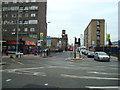
2
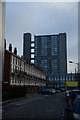
Poplar housing
Housing in Poplar, less than a mile from Canary Wharf.
Image: © Malc McDonald
Taken: 17 Apr 2010
0.02 miles
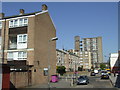
5
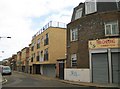
Poplar: Follett Street, E14 (1)
The changing demographics of the East End are visible here. High up on the building on the right is an advert that I can't quite completely decipher, but seems to be advising that the family grocers previously resident there used to have the largest sale of a certain brand of soap in the world. Their shop is now Hin Cheong's Chinese takeaway, while the building with the buff bricks is in use as a Somali community centre.
Image: © Nigel Cox
Taken: 19 Aug 2008
0.05 miles
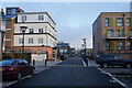
7
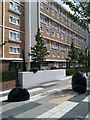
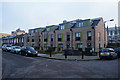
Pavement sculpture outside Langdon House
Image: © David Martin
Taken: 6 Aug 2013
0.06 miles
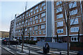
8
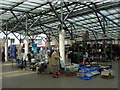
Chrisp Street market, under the canopy
There was a thriving municipal market along Chrisp Street in the Victorian era. In 1951 the area was rebuilt, following wartime damage, as part of the Festival of Britain, and the market relocated in the centre of a new pedestrianized shopping precinct. The canopy was added in the 1980s.
Image: © Natasha Ceridwen de Chroustchoff
Taken: 26 Jun 2008
0.07 miles
9
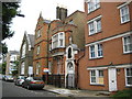
Poplar: Saint Frideswide's Mission House, Lodore Street, E14
Saint Frideswide's Mission House was built in 1892 here in Lodore Street and was originally a mission run by Christ Church, Oxford. At first services were held in a room in this Mission House, but a church was later built in Follett Street at the junction with Lodore Street, where the building on the right is now. The Church was severely damaged during the Blitz, completely demolished in 1947 and never rebuilt.
Behind the black railings at the top of the stone entranceway is a small statue, presumably of the eponymous saint. Saint Frideswide is the patron saint of Oxford, accredited with the founding of Christ Church, hence the connection.
Image: © Nigel Cox
Taken: 19 Aug 2008
0.08 miles