IMAGES TAKEN NEAR TO
North Colonnade, LONDON, E14 4BB
Introduction
This page details the photographs taken nearby to North Colonnade, E14 4BB by members of the Geograph project.
The Geograph project started in 2005 with the aim of publishing, organising and preserving representative images for every square kilometre of Great Britain, Ireland and the Isle of Man.

There are currently over 7.5m images from over14,400 individuals and you can help contribute to the project by visiting https://www.geograph.org.uk
Image Map
Images are licensed for reuse under creativecommons.org/licenses/by-sa/2.0
Notes
- Clicking on the map will re-center to the selected point.
- The higher the marker number, the further away the image location is from the centre of the postcode.
Image Listing (486 Images Found)
Images are licensed for reuse under creativecommons.org/licenses/by-sa/2.0
Image
Details
Distance
1
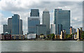
Churchill Place, Canary Wharf
As seen from Trafalgar Way. In the foreground is the car park of Billingsgate Fish Market.
Image: © David Anstiss
Taken: 15 Feb 2012
0.01 miles
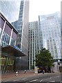
2
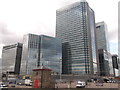
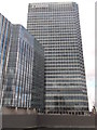
Canary Wharf (2)
Built from the early 1990s.
The rectilinear restraint of its towers contrasts with the increasingly maniacal, right-angle-averse shoutiness of the City's latest batch.
Image: © Stephen Richards
Taken: 26 Sep 2015
0.01 miles
3
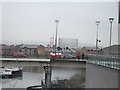
View of the Trafalgar Way bridge and a gas holder in Greenwich from One Churchill Place
Looking south-southeast.
Image: © Robert Lamb
Taken: 24 Nov 2012
0.02 miles
4
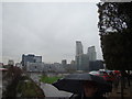
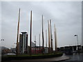
View of Wood Wharf from Trafalgar Way
Looking south-southeast. The green spaces were created for London 2012 and were due to be dug up straight after the Paralympics had finished, but the decision was made to retain them for a further 2 years. Wood Wharf is so named because it was used for the shipping and storage of timber and the repair of ships.
Image: © Robert Lamb
Taken: 24 Nov 2012
0.03 miles
5
Office for Barclays, North Colonnade, Canada Square
Under the tree is the favoured meeting place for smokers from the office building
Image: © David Smith
Taken: 8 Aug 2016
0.03 miles
6
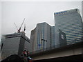
View of the State Street and Barclays buildings from Fraser Place
Looking west-southwest. The building in the middle is the head offices of Balfour Beatty at 5 Churchill Place, Canary Wharf. Thanks to Nigel Cox for this information.
Image: © Robert Lamb
Taken: 24 Nov 2012
0.04 miles
7
View of balustrades on the Trafalgar Way roundabout
Looking south-southeast. Sorry about the slightly impaired quality - the weather was really not on our side today!
Image: © Robert Lamb
Taken: 24 Nov 2012
0.04 miles
8
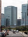
Cartier Circle, Canary Wharf
This roundabout leads from Trafalagar Way to Churchill Place, leading towards Canary Wharf.
In the background is One Canada Water. One of the highest buildings in the area.
Image: © David Anstiss
Taken: 15 Feb 2012
0.04 miles
9
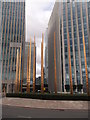
Barclays Building, Churchill Place, Canary Wharf
Main headquarters of the large retail and investment bank.
As seen from Trafalgar Way.
Can you see the size of Bob Diamond's bonus from here!!! ;)
Image: © David Anstiss
Taken: 15 Feb 2012
0.04 miles
10
Barclays & HSBC Tower
Seen from Blackwall Way.
Image: © Oast House Archive
Taken: 26 Jun 2014
0.04 miles