IMAGES TAKEN NEAR TO
Burrells Wharf Square, LONDON, E14 3TH

Introduction

This page details the photographs taken nearby to Burrells Wharf Square, E14 3TH by members of the Geograph project.

The Geograph project started in 2005 with the aim of publishing, organising and preserving representative images for every square kilometre of Great Britain, Ireland and the Isle of Man.

There are currently over 7.5m images from over14,400 individuals and you can help contribute to the project by visiting https://www.geograph.org.uk

Image Map


Images are licensed for reuse under creativecommons.org/licenses/by-sa/2.0
Notes
  • Clicking on the map will re-center to the selected point.
  • The higher the marker number, the further away the image location is from the centre of the postcode.

Image Listing (110 Images Found)

Images are licensed for reuse under creativecommons.org/licenses/by-sa/2.0
  • ...
Image
Details
Distance
1
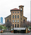
The Plate Shop
Part of Burrell's paintworks, reusing a converted building of the Millwall Ironworks which was used to create the plates for the hulls of iron ships such as the Great Eastern, built and launched close by http://exploringeastlondon.co.uk/eel/Millwall/Millwall.htm#Platehouse .
Image: © Derek Harper Taken: 2 Feb 2011
0.02 miles
2
Westferry Road, Millwall
Image: © Chris Whippet Taken: 10 Sep 2014
0.02 miles
3
Isle of Dogs : Burrells Wharf
Image: © Jim Osley Taken: 23 Jan 2023
0.03 miles
4
The Forge, West Ferry Road
Once part of the Millwall Ironworks, built in 1860 by William Henry Dorman for C J Mare and Co. See the list description (Grade II, list entry 1096069) for a fuller history. Now converted to use as artists' studios. Photographed during the 2019 London Marathon.
Image: © Stephen Craven Taken: 28 Apr 2019
0.04 miles
5
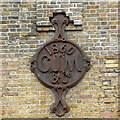
The Forge, West Ferry Road - detail
CJM stands for C J Mare. See the list description (Grade II, list entry 1096069) for a fuller history of this building and Image for a wider view. Now converted to use as artists' studios.
Image: © Stephen Craven Taken: 28 Apr 2019
0.04 miles
6
The Forge, West Ferry Road - history plaque
See Image for a view of the building.
Image: © Stephen Craven Taken: 28 Apr 2019
0.04 miles
7
Isle of Dogs: Burrell's Wharf Square
See Image
Image: © Dr Neil Clifton Taken: 14 Jun 2012
0.04 miles
8
Burrell's Wharf Square
Image: © Steve Daniels Taken: 6 Sep 2013
0.05 miles
9
Isle of Dogs: Burrell's Wharf Square
Burrell's made colour, (paint and dyes), and were one of the last large industrial concerns to leave the area.
Image: © Dr Neil Clifton Taken: 14 Jun 2012
0.05 miles
10
The launch ramp of the Great Eastern at Millwall
Isambard Kingdom Brunel's ship the Great Eastern was constructed here between 1854 and 1857 and was finally launched sideways at 1:42pm on 31st January 1858, aided by an unusually high tide and strong winds. The full story can be seen at https://en.wikipedia.org/wiki/SS_Great_Eastern The site of the launch is still partly visible next to Burrell's Wharf on the Isle of Dogs as can be seen here. She was eventually scrapped at New Ferry on the River Mersey by Henry Bath & Son Ltd in 1889–1890. It took 18 months to take her apart. At the time Everton Football Club were looking for a flagpole for their Anfield ground, and consequently purchased her top mast. It still stands there today at the ground which is now owned by Liverpool Football Club, at the Kop end.
Image: © Marathon Taken: 25 Sep 2020
0.05 miles
  • ...