IMAGES TAKEN NEAR TO
East Ferry Road, LONDON, E14 3LJ
Introduction
This page details the photographs taken nearby to East Ferry Road, E14 3LJ by members of the Geograph project.
The Geograph project started in 2005 with the aim of publishing, organising and preserving representative images for every square kilometre of Great Britain, Ireland and the Isle of Man.

There are currently over 7.5m images from over14,400 individuals and you can help contribute to the project by visiting https://www.geograph.org.uk
Image Map (Loading...)


Getting Data...Please wait
Leaflet Map data © OpenStreetMap
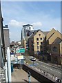
Images are licensed for reuse under creativecommons.org/licenses/by-sa/2.0
Notes
- Clicking on the map will re-center to the selected point.
- The higher the marker number, the further away the image location is from the centre of the postcode.
Image Listing (287 Images Found)
Images are licensed for reuse under creativecommons.org/licenses/by-sa/2.0
Image
Details
Distance
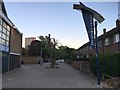
2
Rear of Castilia Square Shops, Isle of Dogs
This row of local shops (including a post office) is part of a development of housing along Manchester Street. Seen from East Ferry Road.
Above, is a row of flats.
Image: © David Anstiss
Taken: 20 Nov 2011
0.02 miles
5
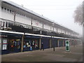
Shops on Castilia Square, Isle of Dogs
This row of local shops (including a post office) is part of a development of housing on Manchester Street.
Above is a row of flats and terraced gardens.
Image: © David Anstiss
Taken: 20 Nov 2011
0.04 miles
6
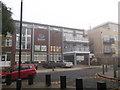
Island House, Isle of Dogs
Community Centre, part of a housing development on Roserton Street.
Seen from Castilia Square.
Image: © David Anstiss
Taken: 20 Nov 2011
0.06 miles
7
Isle of Dogs
A rather appropriate name in some ways
Image: © Graeme Smith
Taken: 6 Jun 2010
0.08 miles
8
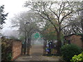
Entrance to St.John's Park
As seen from a path from Galbraith Street.
Image: © David Anstiss
Taken: 20 Nov 2011
0.08 miles
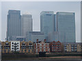
9
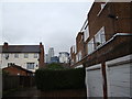
View of the buildings in South Quay from the alley linking Marshfield Street with Strattondale Street
Looking north-northwest.
Image: © Robert Lamb
Taken: 24 Nov 2012
0.09 miles