1
Isle of Dogs
View across the Thames from Ballast Quay in Greenwich
Image: © Richard Croft
Taken: 31 Jan 2009
0.01 miles
2
Kingfield Street, Cubitt Town
Image: © Chris Whippet
Taken: 14 Sep 2014
0.01 miles
3
Billson Street, Cubitt Town
Image: © Chris Whippet
Taken: 14 Sep 2014
0.03 miles
4
Urmston House, Pier Street, E14
One of the flats on the top floor has not been re-clad or had new windows fitted. It is probably one that is owner occupied rather than rented from the local authority. Originally the entire block would have had this appearance.
Image: © Danny P Robinson
Taken: 27 Aug 2009
0.04 miles
5
Parsonage Street, Cubitt Town
Image: © Chris Whippet
Taken: 14 Sep 2014
0.06 miles
6
A feature located in Saunders Ness Park
This feature looks light a light beacon, but there are no historic records of navigational beacons here that I can find.
Further ideas would be appreciated.
Image: © Alan Reynolds
Taken: 30 Apr 2007
0.08 miles
7
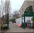
Entrance to Mudchute Park and Farm
On Pier Street, E14
Image: © Danny P Robinson
Taken: 27 Aug 2009
0.08 miles
8
Castleton House, Pier Street, E14
Image: © Danny P Robinson
Taken: 27 Aug 2009
0.09 miles
9
Pier Street, Cubitt Town, Isle of Dogs, London, E14
An entrance to Mudchute Park and, in due course, to its farm. It is a Local Nature Reserve and a Site of Metropolitan Importance for Nature Conservation. The park now covers 13 hectares (32 acres) and the local authority - the London Borough of Tower Hamlets - describes the farm as the largest urban farm in Europe. When Millwall Dock was being constructed in the 1860s, spoil from the excavation of the dock and silt from its channels and waterways were dumped on nearby land, using a conveyor system. Frederic Eliot Duckham (father of Alexander Duckham, who founded the lubricating oil company) invented a pneumatic device that pumped the liquefied waste through a pipe over East Ferry Road, dumping it on the other side of it. Thus the name "Mudchute" derives from the area being the former dumping ground for this waste. After WWII, Mudchute continued to be owned by the Port of London Authority (PLA) but in the early 1970s, when the PLA realised that Millwall Docks would close in the foreseeable future, they negotiated with the Greater London Council to transfer the land to them for house building. However, the Association of Island Communities launched a successful campaign to make sure the land became an open and public space. The newly formed Mudchute Association leased the land (all except that land which was leased to ASDA) from the Council, and a farm and garden was established in 1977.
Image: © David Hallam-Jones
Taken: 2 Apr 2016
0.09 miles
10
The windows in the tower, Saunders Ness Park
This photo shows more detail of the top of the light tower, but the feature is much more overgrown two years later
Image: © Alan Reynolds
Taken: 4 Jul 2009
0.09 miles


