IMAGES TAKEN NEAR TO
Clove Crescent, LONDON, E14 2BE
Introduction
This page details the photographs taken nearby to Clove Crescent, E14 2BE by members of the Geograph project.
The Geograph project started in 2005 with the aim of publishing, organising and preserving representative images for every square kilometre of Great Britain, Ireland and the Isle of Man.

There are currently over 7.5m images from over14,400 individuals and you can help contribute to the project by visiting https://www.geograph.org.uk
Image Map
Images are licensed for reuse under creativecommons.org/licenses/by-sa/2.0
Notes
- Clicking on the map will re-center to the selected point.
- The higher the marker number, the further away the image location is from the centre of the postcode.
Image Listing (184 Images Found)
Images are licensed for reuse under creativecommons.org/licenses/by-sa/2.0
Image
Details
Distance
1
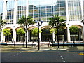
Bridge to Anchorage House
East London Employment Tribunals Service is in this building.
Anchorage House is seen from another angle in http://www.geograph.org.uk/photo/1370968.
Image: © Shazz
Taken: 18 Jul 2014
0.02 miles
2
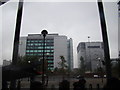
View of industrial buildings from East India Dock DLR station
Looking north-northwest.
Image: © Robert Lamb
Taken: 8 Oct 2012
0.04 miles
3
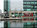
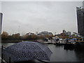
By the dead dock
A route 277 bus waits on Saffron Avenue at its terminus by the remains of the East India Dock. The terminus for this service is actually billed as Nutmeg Lane, the road at the extreme left. The roads here are all named after spices or herbs, in memory of this dock's speciality trade.
Image: © Robin Webster
Taken: 29 Jan 2011
0.05 miles
4
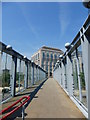
Footbridge over Aspen Way
Aspen Way is the A1261. I don't know the name of the building ahead but it must be offices.
Image: © Shazz
Taken: 18 Jul 2014
0.05 miles
5
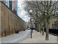
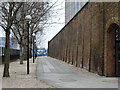
East India Dock boundary wall
Along the south side of the former dock, a grade II listed building, early 19th century.
Image: © Robin Webster
Taken: 29 Jan 2011
0.07 miles
6
View of billboards on the Aspen Way flyover and Tower Hamlets Town Hall from Poplar Dock
Looking north-northeast.
Image: © Robert Lamb
Taken: 24 Nov 2012
0.07 miles
7
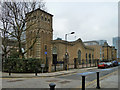
East India Dock Pumping Station
A grade II listed building, mid 19th century. It was provide hydraulic power for cranes, lock gates and other hydraulically operated machinery.
Image: © Robin Webster
Taken: 29 Jan 2011
0.08 miles
9
East India Dock boundary wall
Along the west side of the former dock, a grade II listed building, early 19th century.
Image: © Robin Webster
Taken: 29 Jan 2011
0.08 miles
10
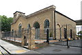
Former East India Dock hydraulic pumping station
Most of East India Dock has been infilled apart from a basin that is a nature reserve. This was a steam powered hydraulic pumping station built in 1857 for the East India Dock Company and extended in 1877 with new engines. Electrified in 1925 and now adaptively reused. This building is on Naval Row and the former tall dock wall is out of shot to the left.
Image: © Chris Allen
Taken: 21 Aug 2011
0.08 miles