
IMAGES TAKEN NEAR TO
Sidney Street, LONDON, E1 3BB
Introduction
This page details the photographs taken nearby to Sidney Street, E1 3BB by members of the Geograph project.
The Geograph project started in 2005 with the aim of publishing, organising and preserving representative images for every square kilometre of Great Britain, Ireland and the Isle of Man.

There are currently over 7.5m images from over14,400 individuals and you can help contribute to the project by visiting https://www.geograph.org.uk
Image Map
Images are licensed for reuse under creativecommons.org/licenses/by-sa/2.0
Notes
- Clicking on the map will re-center to the selected point.
- The higher the marker number, the further away the image location is from the centre of the postcode.
Image Listing (249 Images Found)
Images are licensed for reuse under creativecommons.org/licenses/by-sa/2.0
Image
Details
Distance
1
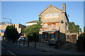
'The Artichoke', Stepney Way, East London
Although it is clearly a post-WWII building, it is fairly obvious that the days of 'The Artichoke' are finished. This large East End pub. is derelict. It is at the junction of Stepney Way with Sidney Street.
Image: © Dr Neil Clifton
Taken: 23 Oct 2007
0.01 miles
2
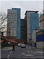
Stepney Way E1
From the junction with Sidney Street. The tall buildings are the rear of the new Royal London Hospital development.
Image: © Robin Sones
Taken: 9 Mar 2012
0.05 miles
3
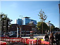
View of the new Royal London Hospital ward from Stepney Way
Looking south-southwest from the Mile End Road/Cambridge Heath Road junction.
Image: © Robert Lamb
Taken: 21 Oct 2011
0.05 miles
4
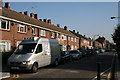
Lindley Street, East London
These attractive small houses were built after the Second World War to replace houses destroyed in the blitz. The nearest group of houses is named 'Callaghan Cottages', presumably in honour of the late prime minister, James Callaghan, who was a tireless worker on behalf of the people of London.
Image: © Dr Neil Clifton
Taken: 23 Oct 2007
0.06 miles
5
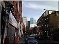
View of the Royal London Hospital extension from the opposite side of Fieldgate Street
Taken further east and on the opposite side of the road along Fieldgate Street.
Image: © Robert Lamb
Taken: 7 Oct 2010
0.07 miles
6
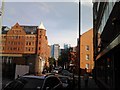
Royal London Hospital extension, viewed from Fieldgate Street
This is featured in Image, on Cavell Street on the opposite side of Whitechapel Road. Looking east-northeast from Fieldgate Street.
Image: © Robert Lamb
Taken: 7 Oct 2010
0.08 miles
7
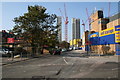
Stepney Way, East London
The road, normally busy, was closed on the day of the photograph, presumably for construction work on the extensions to the London Hospital. In the distance, more skyscrapers for the City can be seen.
Image: © Dr Neil Clifton
Taken: 23 Oct 2007
0.09 miles
8
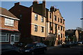
Lindley House, Lindley Street, East London
Lindley House was one building the Luftwaffe did not manage to destroy. It was built in 1910, though what its original purpose was, I do not know. Now it is divided into residential units.
Image: © Dr Neil Clifton
Taken: 23 Oct 2007
0.11 miles
9
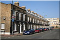
Jubilee Street, East London
This view of Jubilee Street from the end of Lindley Street shows what a pleasant environment exists these days in the East End.
Image: © Dr Neil Clifton
Taken: 23 Oct 2007
0.11 miles
10
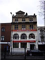
Solicitors Offices in former bank building Whitechapel Road
The offices are at 234-236 Whitechapel Road
London E1.
Image: © PAUL FARMER
Taken: 2 Apr 2010
0.11 miles