IMAGES TAKEN NEAR TO
Surrey Street, LONDON, E13 8RN
Introduction
This page details the photographs taken nearby to Surrey Street, E13 8RN by members of the Geograph project.
The Geograph project started in 2005 with the aim of publishing, organising and preserving representative images for every square kilometre of Great Britain, Ireland and the Isle of Man.

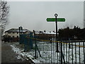
There are currently over 7.5m images from over14,400 individuals and you can help contribute to the project by visiting https://www.geograph.org.uk
Image Map
Images are licensed for reuse under creativecommons.org/licenses/by-sa/2.0
Notes
- Clicking on the map will re-center to the selected point.
- The higher the marker number, the further away the image location is from the centre of the postcode.
Image Listing (103 Images Found)
Images are licensed for reuse under creativecommons.org/licenses/by-sa/2.0
Image
Details
Distance
1
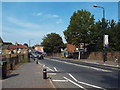
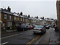
Prince Regent Lane, Plaistow
Prince Regent Lane in Plaistow, in east London.
Image: © Malc McDonald
Taken: 28 Aug 2017
0.03 miles
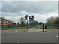
2
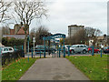
Capital Ring in Plaistow
Along this section, the Capital Ring follows the Greenway, a foot and cycle path along the embankment carrying the Northern Outfall Sewer to the treatment works at Beckton.
This is at one of the road intersections and features one of the solid green signposts which are a feature of the Capital Ring.
Image: © Des Blenkinsopp
Taken: 4 May 2016
0.03 miles
3
From the City's Cemetery to the Greenway (117)
Approaching the intersection of Prince Regent Road with The Greenway.
Image: © Basher Eyre
Taken: 7 Jan 2012
0.03 miles
4
From the City's Cemetery to the Greenway (119)
Traffic lights in Prince Regent Road by The Greenway
Image: © Basher Eyre
Taken: 7 Jan 2012
0.03 miles
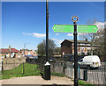
5
Plaistow Station to The Greenway (64)
Signpost on The Grenway
Image: © Basher Eyre
Taken: 19 Jan 2013
0.04 miles
6
Plaistow Station to The Greenway (62)
Looking into Sussex Street from Prince Regent Lane.
Image: © Basher Eyre
Taken: 19 Jan 2013
0.04 miles
7
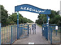
Greenway near Prince Regent Lane
This cycleway / footpath leads from Hackney towards Beckton along a disused railway line.
It is also used by the Capital Ring (long distance path) heading towards Beckton.
Image: © David Anstiss
Taken: 26 Aug 2012
0.04 miles
8
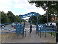
The Greenway crosses Prince Regents Lane
The cycleway / footpath on the disused railway line heads towards Barking Road.
This path is also used by the Capital Ring (long distance path) towards Hackney.
Image: © David Anstiss
Taken: 26 Aug 2012
0.04 miles
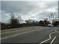
9
The Greenway crosses Prince Regent Road
A path along the Northern Outfall Sewer crosses the A112.
Image: © Robin Webster
Taken: 11 Dec 2010
0.04 miles
10
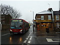
Plaistow Station to The Greenway (61)
Bus in Prince Regent Lane
Image: © Basher Eyre
Taken: 19 Jan 2013
0.04 miles