IMAGES TAKEN NEAR TO
Wanlip Road, LONDON, E13 8QR
Introduction
This page details the photographs taken nearby to Wanlip Road, E13 8QR by members of the Geograph project.
The Geograph project started in 2005 with the aim of publishing, organising and preserving representative images for every square kilometre of Great Britain, Ireland and the Isle of Man.

There are currently over 7.5m images from over14,400 individuals and you can help contribute to the project by visiting https://www.geograph.org.uk
Image Map
Images are licensed for reuse under creativecommons.org/licenses/by-sa/2.0
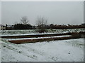
Notes
- Clicking on the map will re-center to the selected point.
- The higher the marker number, the further away the image location is from the centre of the postcode.
Image Listing (77 Images Found)
Images are licensed for reuse under creativecommons.org/licenses/by-sa/2.0
Image
Details
Distance
1
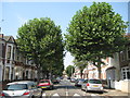
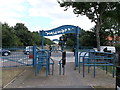
Plaistow: Wigston Road, E13
London Plane trees form an avenue along this road of Victorian houses.
Image: © Nigel Cox
Taken: 3 Aug 2011
0.03 miles
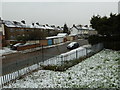
2
Plaistow Station to The Greenway (63)
Looking across The Greenway towards the rear of houses in St Andrew's Road.
Image: © Basher Eyre
Taken: 19 Jan 2013
0.10 miles
4
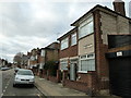
From the City's Cemetery to the Greenway (120)
House in St Andrew's Road
Image: © Basher Eyre
Taken: 7 Jan 2012
0.10 miles
5
Plaistow Station to The Greenway (66)
Looking from The Greenway down into St Andrew's Road
Image: © Basher Eyre
Taken: 19 Jan 2013
0.11 miles
6
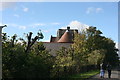
Ancillary building, St Andrew's Church
Grade II listed. http://www.britishlistedbuildings.co.uk/en-204966-buildings-ancillary-to-church-of-st-andr
Image: © N Chadwick
Taken: 1 Nov 2012
0.11 miles
7
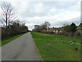
From the City's Cemetery to the Greenway (118)
The Greenway between St Andrew's and Sussex Roads
Image: © Basher Eyre
Taken: 7 Jan 2012
0.12 miles
8
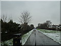
The Greenway crosses Prince Regent Road
A path along the Northern Outfall Sewer crosses the A112.
Image: © Robin Webster
Taken: 11 Dec 2010
0.12 miles
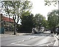
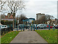
9
The Greenway crosses Prince Regents Lane
The cycleway / footpath on the disused railway line heads towards Barking Road.
This path is also used by the Capital Ring (long distance path) towards Hackney.
Image: © David Anstiss
Taken: 26 Aug 2012
0.12 miles
10
Plaistow Station to The Greenway (65)
Distant jogger heading westwards on The Greenway
Image: © Basher Eyre
Taken: 19 Jan 2013
0.12 miles