IMAGES TAKEN NEAR TO
Chadwin Road, LONDON, E13 8NF
Introduction
This page details the photographs taken nearby to Chadwin Road, E13 8NF by members of the Geograph project.
The Geograph project started in 2005 with the aim of publishing, organising and preserving representative images for every square kilometre of Great Britain, Ireland and the Isle of Man.

There are currently over 7.5m images from over14,400 individuals and you can help contribute to the project by visiting https://www.geograph.org.uk
Image Map
Images are licensed for reuse under creativecommons.org/licenses/by-sa/2.0
Notes
- Clicking on the map will re-center to the selected point.
- The higher the marker number, the further away the image location is from the centre of the postcode.
Image Listing (25 Images Found)
Images are licensed for reuse under creativecommons.org/licenses/by-sa/2.0
Image
Details
Distance
1
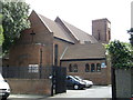
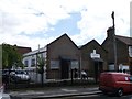
London Ghana Seventh Day Adventist Church, Plaistow
Church on Chadwin Road.
Image: © David Anstiss
Taken: 26 Aug 2012
0.07 miles
3
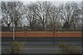
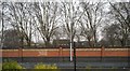
Boundary Wall, Canning Town Recreation Ground
Image: © N Chadwick
Taken: 11 Jan 2018
0.09 miles
4
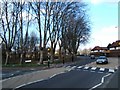
Freemasons Rd, Canning Town
A rare stand of trees in this part of East London at the junction of Freemasons Rd and Russell Rd the photo was taken looking north.
Image: © Glyn Baker
Taken: 4 Mar 2006
0.11 miles
5
Boundary wall, Canning Town Recreation Ground
Image: © N Chadwick
Taken: 11 Jan 2018
0.12 miles
6
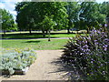
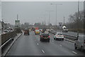
Canning Town Recreation Ground
Canning Town Recreation Ground is immediately south of Newham Way (A13) and between Freemasons Road and Prince Regent Lane. Rosetta Primary School is surrounded by the park on three sides.
Image: © Marathon
Taken: 18 Jun 2014
0.13 miles
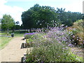
7
Canning Town Recreation Ground
Canning Town Recreation Ground is immediately south of Newham Way (A13) and between Freemasons Road and Prince Regent Lane. Rosetta Primary School is surrounded by the park on three sides.
Image: © Marathon
Taken: 18 Jun 2014
0.13 miles
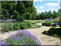
8
Raised flower beds in Canning Town Recreation Ground
Canning Town Recreation Ground is immediately south of Newham Way (A13) and between Freemasons Road and Prince Regent Lane. Rosetta Primary School is surrounded by the park on three sides.
Image: © Marathon
Taken: 18 Jun 2014
0.14 miles
9
Assembles of God (Back to God) Church, Plaistow
Modern church on the junction of Cumberland Road and Holborn Road (on the left).
Image: © David Anstiss
Taken: 26 Aug 2012
0.15 miles
10
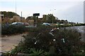
Newham Way, Canning Town
Someone has used the bush as a dustbin.
Image: © David Howard
Taken: 23 Oct 2022
0.16 miles