
IMAGES TAKEN NEAR TO
Buross Street, LONDON, E1 2FA
Introduction
This page details the photographs taken nearby to Buross Street, E1 2FA by members of the Geograph project.
The Geograph project started in 2005 with the aim of publishing, organising and preserving representative images for every square kilometre of Great Britain, Ireland and the Isle of Man.

There are currently over 7.5m images from over14,400 individuals and you can help contribute to the project by visiting https://www.geograph.org.uk
Image Map
Images are licensed for reuse under creativecommons.org/licenses/by-sa/2.0
Notes
- Clicking on the map will re-center to the selected point.
- The higher the marker number, the further away the image location is from the centre of the postcode.
Image Listing (188 Images Found)
Images are licensed for reuse under creativecommons.org/licenses/by-sa/2.0
Image
Details
Distance
1
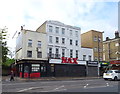
The Hungerford Arms
On Commercial Road (A13).
Image: © JThomas
Taken: 11 May 2019
0.02 miles
2
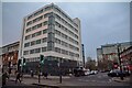
London : Tower Hamlets - Philpot Street
Off Commercial Road and by Chevlot House.
Image: © Lewis Clarke
Taken: 22 Feb 2023
0.03 miles
3
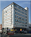
Cheviot House, Commercial Road
The curves give the date away - this must be 1930s. Art Deco windows too, though the top storey must be an unfortunate later addition.
Now offices for Tower Hamlets Council.
Update (2016): it was built in 1937 to the designs of G.G. Winbourne for cloth merchants Kornberg & Segal Ltd. The six upper floors were let out as flatted factories to high-class tailoring firms prior to the building's conversion to council offices in the 1950s. Having been vacant for a while, its future is uncertain and the Twentieth Century Society is supporting a request for its listing.
Image: © Stephen Richards
Taken: 12 Mar 2012
0.04 miles
4
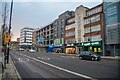
London : Tower Hamlets - Commercial Road A13
Mulberry School for Girls is a secondary school and sixth form for girls located in the Shadwell area of the East End of London
Image: © Lewis Clarke
Taken: 22 Feb 2023
0.04 miles
6
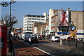
Commercial Road, looking west
From Watney Street
Image: © Dr Neil Clifton
Taken: 23 Oct 2007
0.06 miles
7
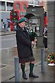
Piper's Lament
A piper on International Workers Memorial Day http://en.wikipedia.org/wiki/Workers'_Memorial_Day marking the deaths of three young workers in 1990 beside the Image
Image: © Glyn Baker
Taken: 28 Apr 2012
0.07 miles
8
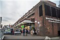
London : Tower Hamlets - Watney Market
The market is situated on the pedestrianised northern portion of Watney Street, which connects Commercial Road and Shadwell DLR station. Located between Whitechapel and Shadwell, the market operates Monday to Saturday, 8.30am to 6pm, with vendors selling a variety of goods.
Image: © Lewis Clarke
Taken: 22 Feb 2023
0.07 miles
9
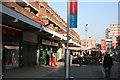
Watney Market, Shadwell, East London
A small street market occupying a pedestrianised part of Watney Street
Image: © Dr Neil Clifton
Taken: 23 Oct 2007
0.07 miles
10
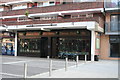
The 'Thomas Neale', Watney Market
A small modern pub in this pedestrianised area.
Image: © Dr Neil Clifton
Taken: 23 Oct 2007
0.07 miles