
IMAGES TAKEN NEAR TO
Mount Terrace, LONDON, E1 2BB
Introduction
This page details the photographs taken nearby to Mount Terrace, E1 2BB by members of the Geograph project.
The Geograph project started in 2005 with the aim of publishing, organising and preserving representative images for every square kilometre of Great Britain, Ireland and the Isle of Man.

There are currently over 7.5m images from over14,400 individuals and you can help contribute to the project by visiting https://www.geograph.org.uk
Image Map
Images are licensed for reuse under creativecommons.org/licenses/by-sa/2.0
Notes
- Clicking on the map will re-center to the selected point.
- The higher the marker number, the further away the image location is from the centre of the postcode.
Image Listing (375 Images Found)
Images are licensed for reuse under creativecommons.org/licenses/by-sa/2.0
Image
Details
Distance
1
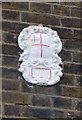
Old Boundary Marker by Mount Terrace, Stepney Parish
Estate Boundary Marker by the UC road, in parish of Stepney (Tower Hamlets District), Mount Terrace E1, on wall of No.30.
Surveyed
Milestone Society National ID: MX_CITY01em.
Image: © Milestone Society
Taken: Unknown
0.00 miles
2
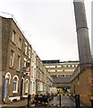
Mount Terrace, Whitechapel
The name of the street recalls a local landmark, The Mount, a substantial hill, removed immediately before the terrace on the left was built in 1808 in order to facilitate the development of the London Hospital. What looks a little like a trampoline on the building at the far end is the London Hospital helipad.
Image: © Derek Harper
Taken: 1 Feb 2011
0.01 miles
3
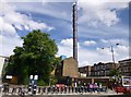
Whitechapel, chimney
Off Mount Terrace; presumably connected with the neighbouring Royal London Hospital.
Image: © Mike Faherty
Taken: 30 Jun 2012
0.02 miles
4
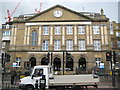
Whitechapel: The Royal London Hospital
This is the now curiously non-symmetrical front façade of the hospital which opened on 20 September 1757 and celebrated its 250th anniversary last year. Contemporary prints of the new building from 1757 see it set in open fields, and show a symmetrical façade. The hospital is now run by the Barts and The London NHS Trust. Extensive rebuilding works are in progress as evidenced by the cranes behind.
Image: © Nigel Cox
Taken: 1 May 2008
0.03 miles
5
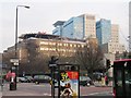
Royal London Hospital, Whitechapel
Showing the helipad and the new blocks rising behind the old hospital.
Image: © Patrick Mackie
Taken: 18 Feb 2011
0.03 miles
6
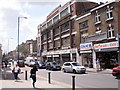
New Road, Whitechapel, London, E1 - 16-7-2009
New Road links Whitechapel Road (A11) near the Royal London Hospital with the Commercial Road (A13).
Image: © Duncan Watts
Taken: 16 Jul 2009
0.03 miles

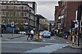
9
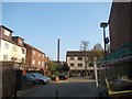
View of the Royal London Hospital chimney from the Old Montague Street/Regal Close junction
Looking south-southeast.
Image: © Robert Lamb
Taken: 24 Mar 2012
0.04 miles
10
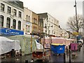
Stalls on Whitechapel Road
Market stalls on the wide pavement by the junction with Vallance Road.
Image: © Derek Harper
Taken: 1 Feb 2011
0.04 miles