IMAGES TAKEN NEAR TO
Railway Arches, Acacia Road, LONDON, E11 3PG
Introduction
This page details the photographs taken nearby to Railway Arches, Acacia Road, E11 3PG by members of the Geograph project.
The Geograph project started in 2005 with the aim of publishing, organising and preserving representative images for every square kilometre of Great Britain, Ireland and the Isle of Man.

There are currently over 7.5m images from over14,400 individuals and you can help contribute to the project by visiting https://www.geograph.org.uk
Image Map
Images are licensed for reuse under creativecommons.org/licenses/by-sa/2.0
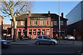
Notes
- Clicking on the map will re-center to the selected point.
- The higher the marker number, the further away the image location is from the centre of the postcode.
Image Listing (52 Images Found)
Images are licensed for reuse under creativecommons.org/licenses/by-sa/2.0
Image
Details
Distance
1
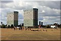
John Lewis Tower and Fredd Wigg Tower
Image: © Oast House Archive
Taken: 1 Aug 2020
0.06 miles
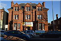
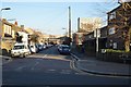
3
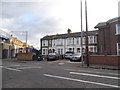
Houses by the railway line on Harrow Road
Image: © David Howard
Taken: 12 Nov 2017
0.10 miles
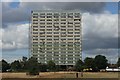
6
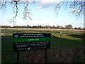
An enclave of Epping Forest
Isolated pieces of Epping Forest, carefully managed and tended by the Corporation of the City of London, are to be found stretching down through east London. This is Wanstead Flats Playing Fields, Leytonstone, E11
Image: © John Davies
Taken: 20 Jan 2006
0.16 miles
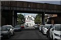
8
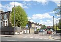
Lancaster Road, Leytonstone
A lot of these residential side streets have been closed to through traffic.
Image: © Des Blenkinsopp
Taken: 29 Apr 2024
0.16 miles