IMAGES TAKEN NEAR TO
Woodville Road, LONDON, E11 3BH
Introduction
This page details the photographs taken nearby to Woodville Road, E11 3BH by members of the Geograph project.
The Geograph project started in 2005 with the aim of publishing, organising and preserving representative images for every square kilometre of Great Britain, Ireland and the Isle of Man.

There are currently over 7.5m images from over14,400 individuals and you can help contribute to the project by visiting https://www.geograph.org.uk
Image Map
Images are licensed for reuse under creativecommons.org/licenses/by-sa/2.0
Notes
- Clicking on the map will re-center to the selected point.
- The higher the marker number, the further away the image location is from the centre of the postcode.
Image Listing (134 Images Found)
Images are licensed for reuse under creativecommons.org/licenses/by-sa/2.0
Image
Details
Distance
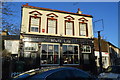
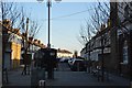
2
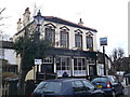
North Star Public House, Leytonstone
On Browning Road.
See Image
Image: © David Anstiss
Taken: 31 Mar 2013
0.12 miles
3
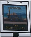
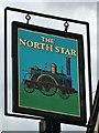
The North Star Pub Sign, Leytonstone
Outside Image
Image: © David Anstiss
Taken: 31 Mar 2013
0.12 miles
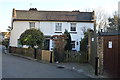
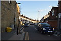
9
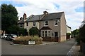
Browning Road
Houses at end of John Drinkwater Road.
Image: © Oast House Archive
Taken: 1 Aug 2020
0.13 miles