
IMAGES TAKEN NEAR TO
Lonsdale Road, LONDON, E11 2PH
Introduction
This page details the photographs taken nearby to Lonsdale Road, E11 2PH by members of the Geograph project.
The Geograph project started in 2005 with the aim of publishing, organising and preserving representative images for every square kilometre of Great Britain, Ireland and the Isle of Man.

There are currently over 7.5m images from over14,400 individuals and you can help contribute to the project by visiting https://www.geograph.org.uk
Image Map
Images are licensed for reuse under creativecommons.org/licenses/by-sa/2.0
Notes
- Clicking on the map will re-center to the selected point.
- The higher the marker number, the further away the image location is from the centre of the postcode.
Image Listing (46 Images Found)
Images are licensed for reuse under creativecommons.org/licenses/by-sa/2.0
Image
Details
Distance
7
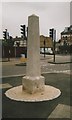
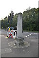
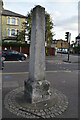
Old Roman Milestone by the A113, New Wanstead Road, Wanstead
Carved stone post by the A11 / A113, in parish of LEYTON (WALTHAM FOREST District), The Leyton Stone (The High Stone), Woodford, on paved area (restored by LB Redbridge 2014). Erected by the Middlesex & Essex turnpike trust in the 19th century.
Inscription not recorded.
Carved bench mark on Southwest face.
Grade II listed.
List Entry Number: 1065570 https://historicengland.org.uk/listing/the-list/list-entry/1065570
Milestone Society National ID: EX_LEY.
Image: © C Woodward
Taken: 21 Mar 2013
0.10 miles
10
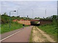
Cycle Path beneath Green Man Interchange
Image: © Roger Smith
Taken: 4 May 2008
0.11 miles