IMAGES TAKEN NEAR TO
Tarbert Walk, LONDON, E1 0ED
Introduction
This page details the photographs taken nearby to Tarbert Walk, E1 0ED by members of the Geograph project.
The Geograph project started in 2005 with the aim of publishing, organising and preserving representative images for every square kilometre of Great Britain, Ireland and the Isle of Man.

There are currently over 7.5m images from over14,400 individuals and you can help contribute to the project by visiting https://www.geograph.org.uk
Image Map
Images are licensed for reuse under creativecommons.org/licenses/by-sa/2.0
Notes
- Clicking on the map will re-center to the selected point.
- The higher the marker number, the further away the image location is from the centre of the postcode.
Image Listing (410 Images Found)
Images are licensed for reuse under creativecommons.org/licenses/by-sa/2.0
Image
Details
Distance
2
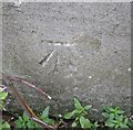
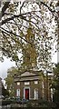
Ordnance Survey Cut Mark
This OS cut mark can be found on the north face of St Paul's Church. It marks a point 10.452m above mean sea level.
Image: © Adrian Dust
Taken: 16 Aug 2016
0.05 miles
3
St Paul's Church, The Highway, London E1 - Chancel
Image: © John Salmon
Taken: 14 Oct 2008
0.05 miles
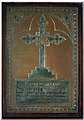
4
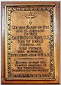
St Paul's Church, The Highway, London E1 - Brass
Image: © John Salmon
Taken: 14 Oct 2008
0.05 miles
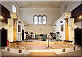
5
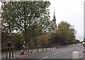
St Paul's Church, The Highway, London E1
Image: © John Salmon
Taken: 14 Oct 2008
0.05 miles
6
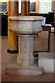
St Paul's Church, The Highway, London E1 - Font
Image: © John Salmon
Taken: 14 Oct 2008
0.05 miles
7
St Paul's Church, The Highway, London E1 - Brass
Image: © John Salmon
Taken: 14 Oct 2008
0.05 miles
8
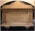
St Paul's Church, The Highway, London E1 - Wall monument
Image: © John Salmon
Taken: 14 Oct 2008
0.05 miles
9
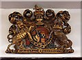
St Paul's Church, The Highway, London E1 - Royal Arms
Image: © John Salmon
Taken: 14 Oct 2008
0.05 miles
10
St Paul's Church, The Highway, London E1
Image: © John Salmon
Taken: 14 Oct 2008
0.05 miles