
IMAGES TAKEN NEAR TO
Devonport Street, LONDON, E1 0EA
Introduction
This page details the photographs taken nearby to Devonport Street, E1 0EA by members of the Geograph project.
The Geograph project started in 2005 with the aim of publishing, organising and preserving representative images for every square kilometre of Great Britain, Ireland and the Isle of Man.

There are currently over 7.5m images from over14,400 individuals and you can help contribute to the project by visiting https://www.geograph.org.uk
Image Map
Images are licensed for reuse under creativecommons.org/licenses/by-sa/2.0
Notes
- Clicking on the map will re-center to the selected point.
- The higher the marker number, the further away the image location is from the centre of the postcode.
Image Listing (154 Images Found)
Images are licensed for reuse under creativecommons.org/licenses/by-sa/2.0
Image
Details
Distance
2
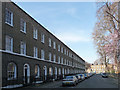
1-16 Albert Gardens
The west side of this early C19th square (the north side of which is formed by Commercial Road). Pleasant three-storey houses in two bays with continuous sillband and arched doorcases. Grade II listed.
Image: © Stephen Richards
Taken: 12 Mar 2012
0.05 miles
3
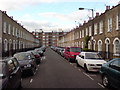
Havering Street, E1
Picture taken from near the railway bridge.
Image: © Danny P Robinson
Taken: 16 Sep 2009
0.06 miles
4
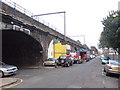
Barnardo Street, E1
About halfway between Shadwell and Limehouse stations, with the main line eventually terminating at Fenchurch Street. The bridge on the left is the access to Havering Street. It is probable that the road was named after Thomas Barnardo, who did much to help poor children locally during the late 19th Century. Here is a link to a history of Barnardo's, which was strongly associated with the East End of London in its early years. http://www.barnardos.org.uk/barnardo_s_history.pdf
Image: © Danny P Robinson
Taken: 16 Sep 2009
0.06 miles
5
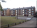
Barnardo Gardens, E1
It is probable that the road was named after Thomas Barnardo, who did much to help poor children locally during the late 19th Century. Here is a link to a history of Barnardo's, which was strongly associated with the East End of London in its early years. http://www.barnardos.org.uk/barnardo_s_history.pdf
Image: © Danny P Robinson
Taken: 16 Sep 2009
0.06 miles
6
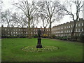
Albert Gardens, Stepney
Nothing to do with the Albert Square from Eastenders, but a very attractive square with its statue facing onto the busy Commercial Road, Stepney.
Image: © Marathon
Taken: 23 Feb 2011
0.07 miles
7
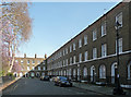
17-28 Albert Gardens
The south side of this early C19th square (the north side of which is formed by Commercial Road). Pleasant three-storey houses in two bays with continuous sillband and arched doorcases. Grade II listed.
Image: © Stephen Richards
Taken: 12 Mar 2012
0.07 miles
8
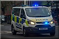
London : Tower Hamlets - Police Van
Looking along Commercial Road with the police van heading along it. The vehicle has done well over 85,000 miles.
Image: © Lewis Clarke
Taken: 22 Feb 2023
0.07 miles
9

Commercial Road, Limehouse
Looking towards Arbour Square
Image: © David Howard
Taken: 9 Jul 2025
0.07 miles
10

Looking up at the clock of the East End Maternity Hospital (now the Steel Lane Health Centre) from Commercial Road
Looking south-southwest.
Image: © Robert Lamb
Taken: 5 Sep 2020
0.07 miles