IMAGES TAKEN NEAR TO
Murcroft Road, STOURBRIDGE, DY9 9HU
Introduction
This page details the photographs taken nearby to Murcroft Road, DY9 9HU by members of the Geograph project.
The Geograph project started in 2005 with the aim of publishing, organising and preserving representative images for every square kilometre of Great Britain, Ireland and the Isle of Man.

There are currently over 7.5m images from over14,400 individuals and you can help contribute to the project by visiting https://www.geograph.org.uk
Image Map
Images are licensed for reuse under creativecommons.org/licenses/by-sa/2.0
Notes
- Clicking on the map will re-center to the selected point.
- The higher the marker number, the further away the image location is from the centre of the postcode.
Image Listing (17 Images Found)
Images are licensed for reuse under creativecommons.org/licenses/by-sa/2.0
Image
Details
Distance
1
Gauden Road
The view up the Dudley street from the junction with Wychbury Road.
Image: © Gordon Griffiths
Taken: 20 Aug 2011
0.11 miles
2
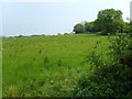
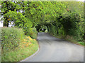
Hodgehole Dingle
The view off Pedmore Lane.
Image: © Gordon Griffiths
Taken: 27 Apr 2007
0.11 miles
3
Queensway View
The view down Wychbury Road, Dudley.
Image: © Gordon Griffiths
Taken: 20 Aug 2011
0.12 miles
4
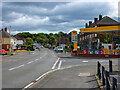
Jet fuel station on Queensway, Wollescote
Exciting fuel prices at the time of submission. The road on the right is Gauden Road; ahead is Queensway but it becomes Walker Avenue in the other direction.
Image: © Oliver Mills
Taken: 18 Sep 2022
0.17 miles
6
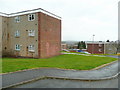
Flats off Dobbins Oak Road
Compare and contrast with Image in the same gridsquare.
Image: © Jonathan Billinger
Taken: 22 Mar 2010
0.18 miles
7
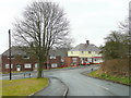
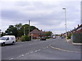
Suburban junction
Looking east along Dobbin's Oak Road towards Queensway.
Image: © Jonathan Billinger
Taken: 22 Mar 2010
0.18 miles
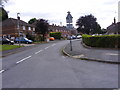
8
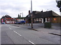
Queensway View
The view of the Queensway Pub on the corner of Gauden Road, Dudley.
Image: © Gordon Griffiths
Taken: 20 Aug 2011
0.19 miles
9
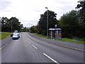
Dobbin's Oak Road Bus Stop
The view down Gauden Road near Pedmore, Dudley.
Image: © Gordon Griffiths
Taken: 20 Aug 2011
0.21 miles
10
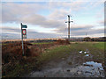
Muddy path on the edge of the 'Black Country'
The 5 blocks of flats in the distance are located at the Delph, near Brierley Hill and the 'hell' that is the Merry Hill Shopping Centre. On the bright side, they're also near to the locally famous 'Bull & Bladder' a haven for real ale enthusiasts (and a pub in which I've had far too many far too often).
Image: © Row17
Taken: 22 Dec 2011
0.22 miles