
IMAGES TAKEN NEAR TO
Harrison Road, STOURBRIDGE, DY8 5XD
Introduction
This page details the photographs taken nearby to Harrison Road, DY8 5XD by members of the Geograph project.
The Geograph project started in 2005 with the aim of publishing, organising and preserving representative images for every square kilometre of Great Britain, Ireland and the Isle of Man.

There are currently over 7.5m images from over14,400 individuals and you can help contribute to the project by visiting https://www.geograph.org.uk
Image Map
Images are licensed for reuse under creativecommons.org/licenses/by-sa/2.0
Notes
- Clicking on the map will re-center to the selected point.
- The higher the marker number, the further away the image location is from the centre of the postcode.
Image Listing (29 Images Found)
Images are licensed for reuse under creativecommons.org/licenses/by-sa/2.0
Image
Details
Distance
1
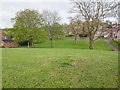
Green space off Swanfield Road
An open green space with grass and trees between Swanfield Road, where the photographer is standing, and Brambleside, the road in the distance.
Image: © David P Howard
Taken: 8 May 2013
0.14 miles
2
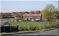
Parkland and houses near Buckpool, Dudley
Looking east across Swan Lane towards housing in Swanfield Road.
Image: © Roger Kidd
Taken: 4 Apr 2007
0.15 miles
3
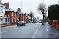
Brettell Lane, Amblecote, Stourbridge
Brettell Lane here forms part of the A461 road. It is passing The Starving Rascal public house on the left. Further along the road, and glimpsed in the far distance on the left, it passes The Swan, another public house.
Image: © P L Chadwick
Taken: 11 Apr 2023
0.17 miles
4
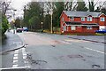
Brettell Lane, Amblecote, Stourbridge
Brettell Lane is here part of the A461 road. The road coming in from the left is Harrison Road. The house on the right is on Dennis Hall Road.
Image: © P L Chadwick
Taken: 11 Apr 2023
0.17 miles
5
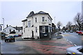
The Starving Rascal
One of Amblecote's several Good Beer Guide entries, on the corner of Collis Street and Brettell Lane.
Image: © Bill Boaden
Taken: 2 Jan 2016
0.17 miles
6
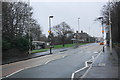
Brettell Lane
Heading towards Brierley Hill. Viewed in drizzle.
Image: © Bill Boaden
Taken: 2 Jan 2016
0.17 miles
7
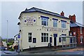
The Starving Rascal (1), 1 Brettell Lane, Amblecote, Stourbridge
Old public house on the corner of Brettell Lane and Cullis Street. It is now one of the chain of real ale (& cider) public houses run by Black Country Ales. When photographed in June 2012 it was run by Enterprise Inns. See:- Image
Image
Image
Image: © P L Chadwick
Taken: 11 Apr 2023
0.17 miles
8
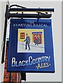
The Starving Rascal (2) - sign, 1 Brettell Lane, Amblecote, Stourbridge
Image: © P L Chadwick
Taken: 11 Apr 2023
0.17 miles
9
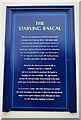
The Starving Rascal (3) - information board, 1 Brettell Lane, Amblecote, Stourbridge
This board, attached to the front of the public house, explains the sad background to the pub's name. Up to 1977 it was known as The Dudley Arms.
Image
Image
Image: © P L Chadwick
Taken: 11 Apr 2023
0.17 miles
10
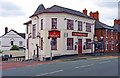
The Starving Rascal (1), 1 Brettell Lane, Amblecote, Stourbridge
An old pub on the corner of Collis Street and Brettell Lane. It normally has five real ales available. Until 1977 it was known as the Dudley Arms and can be found under that name in the 1901 Census.
The pub has an unusual sign, with different designs on the two sides:-
Image; Image
Update: The pub is now run by Black Country Ales as a real ale (& cider) pub. See:- Image.
Image: © P L Chadwick
Taken: 23 Jun 2012
0.17 miles