
IMAGES TAKEN NEAR TO
High Street, STOURBRIDGE, DY8 4NY
Introduction
This page details the photographs taken nearby to High Street, DY8 4NY by members of the Geograph project.
The Geograph project started in 2005 with the aim of publishing, organising and preserving representative images for every square kilometre of Great Britain, Ireland and the Isle of Man.

There are currently over 7.5m images from over14,400 individuals and you can help contribute to the project by visiting https://www.geograph.org.uk
Image Map
Images are licensed for reuse under creativecommons.org/licenses/by-sa/2.0
Notes
- Clicking on the map will re-center to the selected point.
- The higher the marker number, the further away the image location is from the centre of the postcode.
Image Listing (80 Images Found)
Images are licensed for reuse under creativecommons.org/licenses/by-sa/2.0
Image
Details
Distance
1
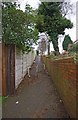
Footpath to High Street, Wollaston, Stourbridge
This footpath links the playing field and open space behind the High Street to that road, which forms part of the A461.
Image: © P L Chadwick
Taken: 6 Jan 2013
0.03 miles
2
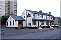
Britannia Inn, 75 High Street, Wollaston
Another of Wollaston's many public houses, the Britannia Inn is overshadowed by the huge multi-storey block of flats nearby. The inn is listed in a trade directory of 1904, but is probably quite a bit older than that.
Image: © P L Chadwick
Taken: 29 Dec 2008
0.03 miles
3
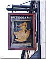
Britannia Inn pub sign, 75 High Street, Wollaston
One of the Enterprise Inns pub chain Image
Image: © P L Chadwick
Taken: 29 Dec 2008
0.03 miles
4
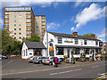
The Britannia Inn
A public house on High Street.
Image: © David P Howard
Taken: 8 May 2013
0.03 miles
5

Dog waste bin and litter bin in playing field, Wollaston, Stourbridge
The dog waste bin, on the left, and the litter bin are on the edge of the playing field, near the footpath link to the High Street. See:- Image
Image: © P L Chadwick
Taken: 6 Jan 2013
0.04 miles
6
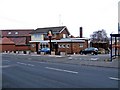
The Barley Mow, Vicarage Road frontage, Wollaston
This pub fronts both Vicarage Road (seen here) and Wollaston's High Street Image A convenient bus shelter adjoins the pub in Vicarage Road. The pub still has signs supplied by Banks's brewery (on both frontages), though that has now been taken over by Marstons.
Image: © P L Chadwick
Taken: 29 Dec 2008
0.06 miles
7
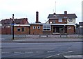
The Barley Mow, 131 High Street, Wollaston
Another of the many pubs in the area, this is unusual in having frontages to two roads, High Street and Vicarage Road.
Image: © P L Chadwick
Taken: 29 Dec 2008
0.06 miles
8
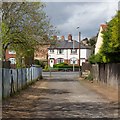
Access to High Street
This access way connects the recreation ground behind the photographer with High Street.
Image: © David P Howard
Taken: 8 May 2013
0.10 miles
9

Lane from playing field to High Street, Wollaston, Stourbridge
The lane is normally closed to motor vehicles by a barrier at the High Street end.
Image
Image: © P L Chadwick
Taken: 26 Apr 2015
0.10 miles
10
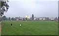
Playing field behind High Street, Wollaston
This very large playing field behind Wollaston's High Street contains two football pitches.
Image: © P L Chadwick
Taken: 27 Sep 2008
0.10 miles